Píritu Municipality, Anzoátegui
| Píritu Municipality Municipio Píritu | |||
|---|---|---|---|
| Municipality | |||
| |||
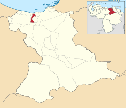 Location in Anzoátegui | |||
.svg.png) Píritu Municipality Location in Venezuela | |||
| Coordinates: 9°52′57″N 65°02′27″W / 9.882406°N 65.040761°WCoordinates: 9°52′57″N 65°02′27″W / 9.882406°N 65.040761°W | |||
| Country |
| ||
| State | Anzoátegui | ||
| Municipal seat | Puerto Píritu | ||
| Government | |||
| • Mayor | Rita Jimenez (PSUV) | ||
| Area | |||
| • Total | 225 km2 (87 sq mi) | ||
| Population (2011) | |||
| • Total | 23,248 | ||
| • Density | 100/km2 (270/sq mi) | ||
| Time zone | UTC−04:00 (VET) | ||
| Area code(s) | 0281 | ||
.png)

The Píritu Municipality is one of the 21 municipalities (municipios) that makes up the eastern Venezuelan state of Anzoátegui and, according to the 2011 census by the National Institute of Statistics of Venezuela, the municipality has a population of 23,248. [1] The town of Píritu, Anzoátegui is the shire town of the Píritu Municipality.[2]
History
The Píritu Municipality separated in 1993 from the Fernando de Peñalver Municipality.
Demographics
The Píritu Municipality, according to a 2007 population estimate by the National Institute of Statistics of Venezuela, has a population of 24,532 (up from 19,834 in 2000). This amounts to 1.7% of the state's population.[3] The municipality's population density is 109.03 inhabitants per square kilometre (282.4/sq mi).[4]
Government
The mayor of the Píritu Municipality is Rita Jimenez, elected on November 23, 2008 with 47% of the vote.[5] She replaced Antonio Barrios shortly after the elections. The municipality is divided into two parishes; Capital Píritu and San Francisco (previous to June 27, 1995, the Píritu Municipality contained only a single parish) .[2]
See also
References
- ↑ http://www.geohive.com/cntry/venezuela_ext.aspx
- 1 2 http://www.ine.gob.ve/secciones/division/Anzoategui.zip%5Bpermanent+dead+link%5D
- ↑ http://www.ine.gob.ve/sintesisestadistica/estados/anzoategui/cuadros/Poblacion5.xls%5Bpermanent+dead+link%5D
- ↑ http://www.ine.gob.ve/sintesisestadistica/estados/anzoategui/cuadros/Poblacion4.xls%5Bpermanent+dead+link%5D
- ↑ http://www.cne.gob.ve/divulgacion_regionales_2008/index.php?e=02&m=00&p=00&c=00&t=00&ca=00&v=02
External links
- piritu-anzoategui.gob.ve (in Spanish)