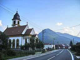
Párnica
| Párnica | |
| Village | |
 | |
| Country | Slovakia |
|---|---|
| Region | Žilina |
| District | Dolný Kubín |
| Elevation | 458 m (1,503 ft) |
| Coordinates | 49°12′N 19°12′E / 49.200°N 19.200°ECoordinates: 49°12′N 19°12′E / 49.200°N 19.200°E |
| Area | 50.405 km2 (19.46 sq mi) |
| Population | 807 |
| Density | 16/km2 (41/sq mi) |
| First mentioned | 1420 |
| Postal code | 027 52 |
| Area code | +421-43 |
| Car plate | DK |
  Location of Párnica in Slovakia | |
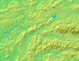  Location of Párnica in the Žilina Region | |
| Statistics: MOŠ/MIS | |
| Website: http://www.parnica.sk/ | |
Párnica is a village and municipality in Dolný Kubín District in the Zilina Region of northern Slovakia.[1]
History
In historical records the village was first mentioned in 1420.
Geography
The municipality lies at an altitude of 458 metres and covers an area of 5405 km². It has a population of about 807 people.[1]
References
External links
This article is issued from
Wikipedia.
The text is licensed under Creative Commons - Attribution - Sharealike.
Additional terms may apply for the media files.