Ouésso Airport
| Ouésso Airport | |||||||||||
|---|---|---|---|---|---|---|---|---|---|---|---|
| Summary | |||||||||||
| Airport type | Public | ||||||||||
| Operator | Government | ||||||||||
| Location | Ouésso | ||||||||||
| Elevation AMSL | 1,158 ft / 353 m | ||||||||||
| Coordinates | 1°36′55″N 16°02′15″E / 1.61528°N 16.03750°ECoordinates: 1°36′55″N 16°02′15″E / 1.61528°N 16.03750°E | ||||||||||
| Map | |||||||||||
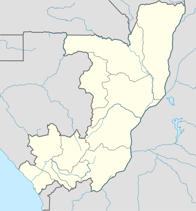 OUE Location in the Republic of the Congo | |||||||||||
| Runways | |||||||||||
| |||||||||||
Ouésso Airport (IATA: OUE, ICAO: FCOU) is an airport serving Ouésso, the capital of the Sangha Department in the Republic of the Congo. Ouésso is on the Sangha River, at the point where it meets the Cameroon border.
The Cameroon border is less than 3 kilometres (2 mi) off the north end of the runway.
The Ouesso non-directional beacon (Ident: OU) is in the town, 1.3 nautical miles (2.4 km) east of the airport.[4]
Airlines and destinations
| Airlines | Destinations |
|---|---|
| Canadian Airways Congo | Brazzaville[5] |
See also

- List of airports in the Republic of the Congo
- Transport in the Republic of the Congo
References
- ↑ Airport information for Ouésso Airport
- ↑ Airport information for Ouésso Airport at Great Circle Mapper.
- ↑ Google Maps - Ouésso
- ↑ "Ouesso NDB (OU) @ OurAirports". ourairports.com. Retrieved 2018-08-20.
- ↑ "Canadian Airways Congo - Programmes des vols". Retrieved 4 September 2014.
External links
- OpenStreetMap - Ouésso
- FallingRain - Ouésso Airport
- OurAirports - Ouésso
- Accident history for Ouésso Airport at Aviation Safety Network
- Current weather for Ouesso, Republic of the Congo at NOAA/NWS
This article is issued from
Wikipedia.
The text is licensed under Creative Commons - Attribution - Sharealike.
Additional terms may apply for the media files.