Djambala Airport
| Djambala Airport | |||||||||||
|---|---|---|---|---|---|---|---|---|---|---|---|
| Summary | |||||||||||
| Airport type | Public | ||||||||||
| Serves | Djambala, Republic of the Congo | ||||||||||
| Elevation AMSL | 2,595 ft / 791 m | ||||||||||
| Coordinates | 2°31′10″S 14°45′10″E / 2.51944°S 14.75278°ECoordinates: 2°31′10″S 14°45′10″E / 2.51944°S 14.75278°E | ||||||||||
| Map | |||||||||||
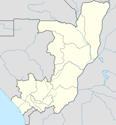 DJM Location of airport in the Republic of the Congo | |||||||||||
| Runways | |||||||||||
| |||||||||||
Djambala Airport (IATA: DJM, ICAO: FCBD) is an airport serving Djambala, a city in the Plateaux Department of Republic of the Congo.
See also

- List of airports in the Republic of the Congo
- Transport in the Republic of the Congo
References
- ↑ Airport information for Djambala Airport at Great Circle Mapper.
- ↑ Google Maps - Djambala
External links
- OurAirports - Djambala
- OpenStreetMaps - Djambala
- Accident history for Djambala Airport at Aviation Safety Network
This article is issued from
Wikipedia.
The text is licensed under Creative Commons - Attribution - Sharealike.
Additional terms may apply for the media files.