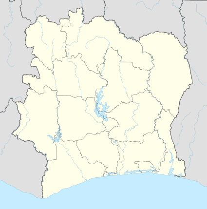
Ouangolodougou, Ivory Coast
| Ouangolodougou Wangolodougou | |
|---|---|
| Town, sub-prefecture, and commune | |
 Ouangolodougou Location in Côte d'Ivoire | |
| Coordinates: 9°58′N 5°9′W / 9.967°N 5.150°W | |
| Country |
|
| Region | Savanes |
| Region | Tchologo |
| Department | Ouangolodougou |
| Elevation | 303 m (994 ft) |
| Population (2014)[1] | |
| • Total | 74,519 |
| Time zone | UTC+0 (GMT) |
Ouangolodougou (also known as Wangolodougou) is a town in the far north of Ivory Coast. It is a sub-prefecture of and the seat of Ouangolodougou Department in Tchologo Region, Savanes District. Ouangolodougou is also a commune.
Ouangolodougou is in the sub-Saharan Sahel savanna biogeography region, which is characterised by grasslands with trees.
Transport
The town is served by a station on the Abidjan-Niger Railway.
References
- ↑ "Côte d'Ivoire". geohive.com. Retrieved 14 December 2015.
Regional seat: Ferkessédougou | ||
| Ferkessédougou Department | 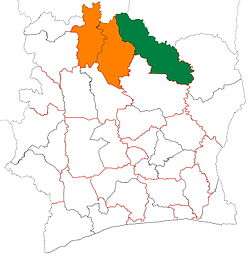 | |
| Kong Department | ||
| Ouangolodougou Department | ||
* also a commune | ||
This article is issued from
Wikipedia.
The text is licensed under Creative Commons - Attribution - Sharealike.
Additional terms may apply for the media files.