Osternienburger Land
| Osternienburger Land | ||
|---|---|---|
| ||
 Osternienburger Land Location of Osternienburger Land within Anhalt-Bitterfeld district 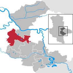 | ||
| Coordinates: 51°48′N 12°1′E / 51.800°N 12.017°ECoordinates: 51°48′N 12°1′E / 51.800°N 12.017°E | ||
| Country | Germany | |
| State | Saxony-Anhalt | |
| District | Anhalt-Bitterfeld | |
| Government | ||
| • Mayor | Stefan Hemmerling (CDU) | |
| Area | ||
| • Total | 138.7 km2 (53.6 sq mi) | |
| Elevation | 71 m (233 ft) | |
| Population (2017-12-31)[1] | ||
| • Total | 8,652 | |
| • Density | 62/km2 (160/sq mi) | |
| Time zone | CET/CEST (UTC+1/+2) | |
| Postal codes | 06386 | |
| Dialling codes | 034909, 03496, 034973, 034977, 034979 | |
| Vehicle registration | ABI | |

Osternienburger Land is a municipality in the district of Anhalt-Bitterfeld, in Saxony-Anhalt, Germany. It was formed on 1 January 2010 by the merger of the former municipalities Chörau, Diebzig, Dornbock, Drosa, Elsnigk, Großpaschleben, Kleinpaschleben, Libbesdorf, Micheln, Osternienburg, Reppichau, Trinum, Wulfen and Zabitz.
Towns and municipalities in the district of Anhalt-Bitterfeld | ||
|---|---|---|
References
This article is issued from
Wikipedia.
The text is licensed under Creative Commons - Attribution - Sharealike.
Additional terms may apply for the media files.