Ostereidet
| Ostereidet | |
|---|---|
| Village | |
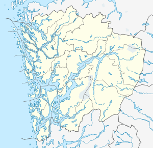
 Ostereidet Location in Hordaland county  Ostereidet Ostereidet (Norway) | |
| Coordinates: 60°37′23″N 05°28′42″E / 60.62306°N 5.47833°ECoordinates: 60°37′23″N 05°28′42″E / 60.62306°N 5.47833°E | |
| Country | Norway |
| Region | Western Norway |
| County | Hordaland |
| District | Nordhordland |
| Municipality | Lindås |
| Elevation[1] | 24 m (79 ft) |
| Time zone | UTC+01:00 (CET) |
| • Summer (DST) | UTC+02:00 (CEST) |
| Post Code | 5993 Ostereidet |
Ostereidet is a village in Lindås municipality in Hordaland county, Norway. The village is located along the Osterfjorden in eastern Lindås. The European route E39 highway runs through the village. Ostereidet is one of the larger settlements in eastern Lindås, and it is the site of Ostereidet Church. The village of Askeland lies about 5 kilometres (3.1 mi) to the north, near the Austfjorden.
References
- ↑ "Ostereidet" (in Norwegian). yr.no. Retrieved 2014-03-25.
This article is issued from
Wikipedia.
The text is licensed under Creative Commons - Attribution - Sharealike.
Additional terms may apply for the media files.