Orval, Manche
| Orval | |
|---|---|
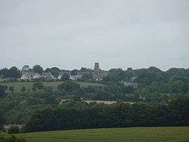 Orval seen from Hyenville church | |
 Orval Location within Normandy region  Orval | |
| Coordinates: 49°00′54″N 1°28′13″W / 49.015°N 1.4703°WCoordinates: 49°00′54″N 1°28′13″W / 49.015°N 1.4703°W | |
| Country | France |
| Region | Normandy |
| Department | Manche |
| Arrondissement | Coutances |
| Canton | Coutances |
| Intercommunality | Communauté de communes de Montmartin-sur-Mer |
| Government | |
| • Mayor (2008–2014) | Joël Doyère |
| Area1 | 12.54 km2 (4.84 sq mi) |
| Population (2006)2 | 878 |
| • Density | 70/km2 (180/sq mi) |
| Demonym(s) | Orvalais |
| Time zone | UTC+1 (CET) |
| • Summer (DST) | UTC+2 (CEST) |
| INSEE/Postal code | 50388 /50660 |
| Elevation |
4–88 m (13–289 ft) (avg. 96 m or 315 ft) |
|
1 French Land Register data, which excludes lakes, ponds, glaciers > 1 km2 (0.386 sq mi or 247 acres) and river estuaries. 2 Population without double counting: residents of multiple communes (e.g., students and military personnel) only counted once. | |
Orval is a former commune in the Manche department in Normandy in north-western France. On 1 January 2016, it was merged into the new commune of Orval-sur-Sienne.[1]
See also
References
- ↑ Arrêté préfectoral 25 November 2015 (in French)
| Wikimedia Commons has media related to Orval (Manche). |
This article is issued from
Wikipedia.
The text is licensed under Creative Commons - Attribution - Sharealike.
Additional terms may apply for the media files.