Orrin, North Dakota
| Orrin, North Dakota | |
|---|---|
| Census-designated place & Unincorporated community | |
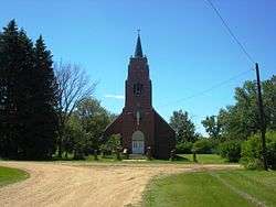 Sacred Heart Catholic Church | |
 Orrin, North Dakota | |
| Coordinates: 48°05′29″N 100°09′47″W / 48.09139°N 100.16306°WCoordinates: 48°05′29″N 100°09′47″W / 48.09139°N 100.16306°W | |
| Country | United States |
| State | North Dakota |
| County | Pierce |
| Area[1] | |
| • Total | 0.23 sq mi (0.6 km2) |
| • Land | 0.23 sq mi (0.6 km2) |
| • Water | 0 sq mi (0 km2) |
| Elevation | 1,562 ft (476 m) |
| Population (2010)[2] | |
| • Total | 22 |
| • Density | 96/sq mi (37/km2) |
| Time zone | UTC-6 (Central (CST)) |
| • Summer (DST) | UTC-5 (CDT) |
| ZIP code | 58368 |
| Area code(s) | 701 |
| FIPS code | 38-59820 |
| GNIS feature ID | 1030580[3] |
Orrin is a census-designated place and unincorporated community in Pierce County, North Dakota, United States. Its population was 22 as of the 2010 census.[2]
Old Saint John Nepomocene Cemetery, Wrought-Iron Cross Site and St. Mathias Cemetery, Wrought-Iron Cross Site, both in or near Orrin, are listed on the National Register of Historic Places.
Geography
Orrin is located at 48°05′29″N 100°09′47″W / 48.09139°N 100.16306°W (48.091389, −100.163056).[1]
According to the United States Census Bureau, the CDP has a total area of 0.23 square miles (0.60 km2), all of it land.[1]
Demographics
2010 census
As of the census[4] of 2010, there were 22 people, 5 households, and 5 families residing in the CDP. The population density was 95.7 inhabitants per square mile (36.9/km2). There were 17 housing units at an average density of 73.9 per square mile (28.5/km2). The racial makeup of the CDP was 77.3% White, and 22.7% African American.
There were 5 households of which 80.0% had children under the age of 18 living with them, 40.0% were married couples living together, 20.0% had a female householder with no husband present, and 40.0% had a male householder with no wife present. 0.0% of all households were made up of individuals. The average household size was 4.40 and the average family size was 4.20.
The median age in the CDP was 17.3 years. 59.1% of residents were under the age of 18; 4.5% were between the ages of 18 and 24; 18.2% were from 25 to 44; 9.1% were from 45 to 64; and 9.1% were 65 years of age or older. The gender makeup of the CDP was 63.6% male and 36.4% female.
References
- 1 2 3 "US Gazetteer files: 2010, 2000, and 1990". United States Census Bureau. February 12, 2011. Retrieved 2011-04-23.
- 1 2 "American FactFinder". United States Census Bureau. Retrieved 2011-05-14.
- ↑ "Orrin". Geographic Names Information System. United States Geological Survey.
- ↑ "American FactFinder". United States Census Bureau. Retrieved 2017-06-21.
Municipalities and communities of Pierce County, North Dakota, United States | ||
|---|---|---|
| Cities | 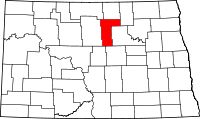 | |
| Townships |
| |
| CDPs | ||
| Unorganized territories |
| |
| Unincorporated communities |
| |