Ord of Caithness
| Ord of Caithness | |
|---|---|
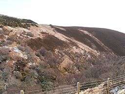 The Ord, seen from the west, from the A9 road on the other side of Ord Burn | |
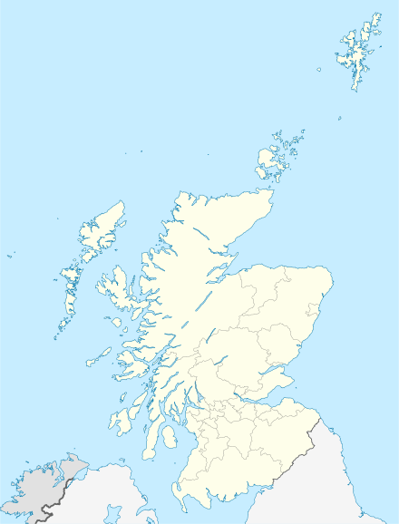 Location in Scotland | |
| OS grid | ND056178 |
| Coordinates | 58°8′22″N 3°36′15″W / 58.13944°N 3.60417°WCoordinates: 58°8′22″N 3°36′15″W / 58.13944°N 3.60417°W |
| Elevation | 198 metres (650 ft) |
| Geology | Granite |
The Ord of Caithness is a granite mass on the east coast of the Highland council area of Scotland, on the boundary of the counties Sutherland and Caithness. It is 2 miles (3.2 km) north-east of Helmsdale. It forms a headland 198 metres (650 ft) high, known as Ord Point. The A9 road passes above the Ord; there are sharp bends as it follows the contours.[1]
History
Historically, "the grim barrier of the Ord guaranteed its [i.e. Caithness's] isolation, and travellers who passed that way were greatly impressed by the experience."[2] It was described in the 1880s: "The old road over it, formerly the only land ingress to Caithness, traversed the crest of its stupendous seaward precipices at a height and in a manner most appalling to both man and beast... even the present road, formed in 1811... has very stiff gradients."[3]
References
- ↑ Ord of Caithness Gazetteer for Scotland, accessed 8 August 2016.
- ↑ James Miller, Caithness. Skilton & Shaw, 1979. Page 97.
- ↑ Francis Groome, Ordnance Gazetteer of Scotland, 1882–4. Quoted in Ord of Caithness Vision of Britain, accessed 8 August 2016.