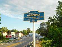
Orbisonia, Pennsylvania
| Orbisonia, Pennsylvania | |
|---|---|
| Borough | |
 The East Broad Top Railroad ran through Orbisonia. | |
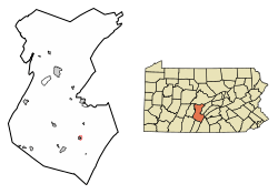 Location of Orbisonia in Huntingdon County, Pennsylvania. | |
 Orbisonia Location of Orbisonia in Huntingdon County, Pennsylvania.  Orbisonia Orbisonia (the US) | |
| Coordinates: 40°14′36″N 77°53′36″W / 40.24333°N 77.89333°WCoordinates: 40°14′36″N 77°53′36″W / 40.24333°N 77.89333°W | |
| Country | United States |
| State | Pennsylvania |
| County | Huntingdon |
| Government | |
| • Type | Borough Council |
| Area[1] | |
| • Total | 0.10 sq mi (0.25 km2) |
| • Land | 0.10 sq mi (0.25 km2) |
| • Water | 0.00 sq mi (0.00 km2) |
| Population (2010) | |
| • Total | 428 |
| • Estimate (2016)[2] | 414 |
| • Density | 4,224.49/sq mi (1,637.71/km2) |
| Time zone | UTC-5 (Eastern (EST)) |
| • Summer (DST) | UTC-4 (EDT) |
| ZIP code | 17243 |
| Area code(s) | 814 |
| FIPS code | 42-56928 |
| Local phone exchanges: 447, 448 | |
Orbisonia is a borough in Huntingdon County, Pennsylvania, United States. The population was 428 at the 2010 census.[3]
Geography
Orbisonia is located in southeastern Huntingdon County at 40°14′36″N 77°53′36″W / 40.24333°N 77.89333°W (40.243345, -77.893362),[4] on the northeast side of Blacklog Creek, a tributary of Aughwick Creek and part of the Juniata River watershed. Orbisonia is bordered to the southwest by Rockhill, across Blacklog Creek. Blacklog Mountain confines the borough to the east.
U.S. Route 522 passes through Orbisonia, leading north 10 miles (16 km) to Mount Union and south 5 miles (8 km) to Shade Gap.
According to the United States Census Bureau, Orbisonia has a total area of 0.097 square miles (0.25 km2), all of it land.[3]
Demographics
| Historical population | |||
|---|---|---|---|
| Census | Pop. | %± | |
| 1860 | 188 | — | |
| 1870 | 177 | −5.9% | |
| 1880 | 766 | 332.8% | |
| 1890 | 963 | 25.7% | |
| 1900 | 653 | −32.2% | |
| 1910 | 618 | −5.4% | |
| 1920 | 682 | 10.4% | |
| 1930 | 741 | 8.7% | |
| 1940 | 729 | −1.6% | |
| 1950 | 648 | −11.1% | |
| 1960 | 643 | −0.8% | |
| 1970 | 554 | −13.8% | |
| 1980 | 506 | −8.7% | |
| 1990 | 447 | −11.7% | |
| 2000 | 425 | −4.9% | |
| 2010 | 428 | 0.7% | |
| Est. 2016 | 414 | [2] | −3.3% |
| Sources:[5][6][7] | |||
As of the census[6] of 2000, there were 425 people, 198 households, and 109 families residing in the borough. The population density was 4,790.2 people per square mile (1,823.3/km²). There were 217 housing units at an average density of 2,445.8 per square mile (930.9/km²). The racial makeup of the borough was 99.06% White, 0.24% African American, 0.24% Native American, and 0.47% from two or more races. Hispanic or Latino of any race were 0.47% of the population.
There were 198 households, out of which 24.2% had children under the age of 18 living with them, 42.4% were married couples living together, 8.6% had a female householder with no husband present, and 44.9% were non-families. 44.4% of all households were made up of individuals, and 29.8% had someone living alone who was 65 years of age or older. The average household size was 2.15 and the average family size was 3.00.
In the borough, the population was spread out, with 22.8% under the age of 18, 4.7% from 18 to 24, 24.0% from 25 to 44, 21.4% from 45 to 64, and 27.1% who were 65 years of age or older. The median age was 44 years. For every 100 females, there were 90.6 males. For every 100 females age 18 and over, there were 82.2 males.
The median income for a household in the borough was $25,000, and the median income for a family was $38,333. Males had a median income of $31,250 versus $20,625 for females. The per capita income for the borough was $16,911. About 5.8% of families and 11.0% of the population were below the poverty line, including 7.4% of those under age 18 and 19.8% of those age 65 or over.
Public services
Emergency services
- Orbisonia and Rockhill Volunteer Fire Company
Health care
- Southern Huntingdon County Medical Center
Postal services
- Orbisonia Post Office
Non-profit organizations
- Orbisonia Lions Club
- Orbisonia Food Pantry
References
- ↑ "2016 U.S. Gazetteer Files". United States Census Bureau. Retrieved Aug 14, 2017.
- 1 2 "Population and Housing Unit Estimates". Retrieved June 9, 2017.
- 1 2 "Geographic Identifiers: 2010 Census Summary File 1 (G001): Orbisonia borough, Pennsylvania". American Factfinder. U.S. Census Bureau. Retrieved January 22, 2018.
- ↑ "US Gazetteer files: 2010, 2000, and 1990". United States Census Bureau. 2011-02-12. Retrieved 2011-04-23.
- ↑ "Census of Population and Housing". U.S. Census Bureau. Archived from the original on May 12, 2015. Retrieved 11 December 2013.
- 1 2 "American FactFinder". United States Census Bureau. Retrieved 2008-01-31.
- ↑ "Incorporated Places and Minor Civil Divisions Datasets: Subcounty Resident Population Estimates: April 1, 2010 to July 1, 2012". Population Estimates. U.S. Census Bureau. Archived from the original on June 17, 2013. Retrieved 11 December 2013.
Municipalities and communities of Huntingdon County, Pennsylvania, United States | ||
|---|---|---|
| Boroughs | 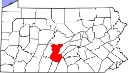 | |
| Townships | ||
| CDPs | ||
| Unincorporated communities | ||
| Ghost town | ||
| Footnotes | ‡This populated place also has portions in an adjacent county or counties | |