Orb (river)
| Orb | |
|---|---|
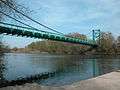
 The Orb in Béziers. | |
| Native name | L'Orb (m) |
| Country | France |
| Physical characteristics | |
| Main source |
Massif Central 820 m (2,690 ft) |
| River mouth |
Mediterranean Sea 43°14′47″N 3°17′54″E / 43.24639°N 3.29833°ECoordinates: 43°14′47″N 3°17′54″E / 43.24639°N 3.29833°E |
| Length | 136 km (85 mi) |
| Discharge |
|
| Basin features | |
| Basin size | 1,400 km2 (540 sq mi) |
The Orb is a 145-kilometre (90 mi) long river in the Herault département of southern France that flows into the Mediterranean Sea, in Valras-Plage. The river flows through the towns Bédarieux and Béziers, where it is crossed by the canal du Midi on the Orb Aqueduct. In ancient times, the Orb was crossed at Capestang by the 1,500-metre (4,900 ft) long Roman Pont Serme.[1]
Geography
The Orb flows through the following towns:


Tributaries
The following rivers flows into the Orb:
- Jaur 30 kilometres (19 mi)
- Lirou 30 kilometres (19 mi)
- Mare 29 kilometres (18 mi)
- Taurou 25 kilometres (16 mi)
- Vernazobre 24 kilometres (15 mi)
- Rieutort 18 kilometres (11 mi)
- Héric 14 kilometres (9 mi)
References
External links
| Wikimedia Commons has media related to Orb River. |
| Authority control |
|---|
This article is issued from
Wikipedia.
The text is licensed under Creative Commons - Attribution - Sharealike.
Additional terms may apply for the media files.