Oraville, Maryland
| Oraville, Maryland | |
|---|---|
| Unincorporated community | |
 Oraville | |
| Coordinates: 38°25′04″N 76°41′39″W / 38.41778°N 76.69417°WCoordinates: 38°25′04″N 76°41′39″W / 38.41778°N 76.69417°W | |
| Country | United States |
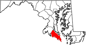
| State | Maryland |
| County | St. Mary's |
| Elevation | 157 ft (48 m) |
| Time zone | UTC-5 (Eastern (EST)) |
| • Summer (DST) | UTC-4 (EDT) |
| Area code(s) | 301 & 240 |
| GNIS feature ID | 594856[1] |
Oraville is an unincorporated community in St. Mary's County, Maryland, United States. Oraville is located at the intersection of Maryland Route 6 and Maryland Route 235 6.3 miles (10.1 km) southeast of Charlotte Hall.
The name Oraville is believed to be named after a Girl named Ora Hopkins. Her Stepfather Nicholas S Hopkins ran a millinery store in the early 1900's which was also a Post office on the corner of Morganza Turner Rd and Rt 235. The house still stands but is in ruins now.
References
This article is issued from
Wikipedia.
The text is licensed under Creative Commons - Attribution - Sharealike.
Additional terms may apply for the media files.