Ongar Rural District
| Ongar | |
|---|---|
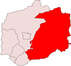 The district in 1911 | |
| Area | |
| • 1911 | 47.236 acres (191,160 m2) |
| • 1951 | 47,234 acres (191.15 km2) |
| Population | |
| • 1901 | 10,044 |
| • 1951 | 14,866 |
| History | |
| • Created | 1894 |
| • Abolished | 1955 |
| • Succeeded by | Epping and Ongar Rural District |
| Status | Rural district |
| • HQ | Chipping Ongar |
Ongar Rural District was a local government district in Essex, England from 1894 to 1955.[1] It included the small town of Chipping Ongar and the parishes surrounding it.
It was abolished in 1955 and combined with part of Epping Rural District to create Epping and Ongar Rural District.
References
- ↑ - Ongar RD
Coordinates: 51°42′N 0°15′E / 51.70°N 0.25°E
This article is issued from
Wikipedia.
The text is licensed under Creative Commons - Attribution - Sharealike.
Additional terms may apply for the media files.