Ommoord
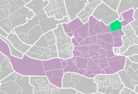
Ommoord is a neighbourhood in the borough Prins Alexander, part of the municipality of Rotterdam, South Holland, the Netherlands. Ommoord is surrounded by the neighbourhoods Zevenkamp, Het Lage Land and Terbregge. It has around 25.000 inhabitants across 12.500 households.
The river Rotte flows through the north of Ommoord.
Neighbourhoods
Ommoord has 15 neighbourhoods: Bloemenbuurt (Flower-neighbourhood), Bremmenbuurt (Broom), Distelbuurt (Thistle), Doornenbuurt (Thorn), Grasbuurt (Grass), Heidebuurt (heather), Bessenbuurt (Berry), Klaverbuurt (Clover), Kruidenbuurt (Herbs), Middengebied-West (Middle area-West), Middengebied-Centrum (Middle area-Center, Middengebied-Oost (Middle area-East), Mossenbuurt (Moss), Rozenbuurt (Rose) and the Varenbuurt (Fern).
Public transport
Two buslines extend into Ommoord: 34 en 35.
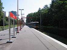
The Calandlijn line of the Rotterdam subway extends into Ommoord and has 4 stations in it:
- Graskruid (both Ommoord and Nesselande branches)
- Romeynshof (Ommoord branch)
- Binnenhof (terminus for Ommoord branch)
- Hesseplaats (Nesselande branch)
External links
- (in Dutch) List of links about Ommoord
Coordinates: 51°57′44″N 4°33′02″E / 51.96222°N 4.55056°E