Okuizumo, Shimane
| Okuizumo 奥出雲町 | |||
|---|---|---|---|
| Town | |||
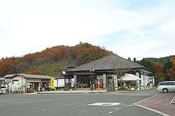 Roadside Station Okuizumo | |||
| |||
|
Location of Okuizumo in Shimane Prefecture | |||
 Okuizumo Location in Japan | |||
| Coordinates: 35°10′N 133°6′E / 35.167°N 133.100°ECoordinates: 35°10′N 133°6′E / 35.167°N 133.100°E | |||
| Country | Japan | ||
| Region |
Chūgoku San'in | ||
| Prefecture | Shimane Prefecture | ||
| District | Nita | ||
| Area | |||
| • Total | 368.06 km2 (142.11 sq mi) | ||
| Population (March 1, 2017) | |||
| • Total | 12,655 | ||
| • Density | 34/km2 (89/sq mi) | ||
| Time zone | UTC+9 (JST) | ||
| Website |
www | ||
Okuizumo (奥出雲町 Okuizumo-chō) is a town located in Nita District, Shimane Prefecture, Japan.
It was formed on March 31, 2005 from the merger of the towns of Nita and Yokota.
As of March 1, 2017, the town has a population of 12,655 and a density of 34 persons per km². The area is 368.06 km².
History
The town of Okuizumo was one of the early centers of Tatara iron making method and remains the only modern site of it, producing a steel for the traditional Japanese swords.[1]
Nearby Komaki mine was used to produce tungsten from 1911 to 1984.[2]
References
External links

- Okuizumo official website (in Japanese)
This article is issued from
Wikipedia.
The text is licensed under Creative Commons - Attribution - Sharealike.
Additional terms may apply for the media files.