Ohio to Erie Trail
| Ohio to Erie Trail | |
|---|---|
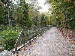 Ohio and Erie Canal Towpath Trail, located in the Cuyahoga Valley National Park | |
| Length | 318 mi (512 km)[1] |
| Location | Ohio, United States |
| Designation |
|
| Trailheads | Cincinnati to Cleveland (various) |
| Use | Multi-use |
| Hiking details | |
| Season | Year-round |
| Website |
www |
The Ohio to Erie Trail is a route for non-motorists that traverses the U.S. state of Ohio, from southwest to northeast. It is named for its endpoints, the Ohio River at Cincinnati and Lake Erie at Cleveland. The route largely consists of rail trails and other multi-use trails but also includes some on-road segments in anticipation of future segregated cycle facilities. The route as a whole is intended for bicyclists and hikers, while some trails along the route also permit equestrian and horse and buggy traffic.[2]
History
The Ohio to Erie trail was first envisioned in 1991 by Edward Franklin Honton, who subsequently founded and served as president of a non-profit organization dedicated to making the trail a reality.[3] After his death in 2005, his legacy continued through the organization he founded, The Ohio to Erie Trail Fund. In a fitting tribute to the former Franklin County Engineer, the historic Bridgeview Bridge was dedicated in memory of Ed Honton, during the opening of the Alum Creek Trail near Innis Park on July 15, 2011.[4] The bridge is a fully restored 1902 structure which originally carried Beach Road and Lucas Road over the Big Darby Creek.
The Ohio to Erie Trail began in 1991 as an outgrowth of the Ohio Bicycle Advisory Council.[5]
Path
The trail is divided into four separate sections:[1]
- Northern leg: Cleveland to Massillon
- Heart of Ohio leg: Massillon to Mount Vernon
- Central Ohio leg: Mount Vernon to London
- Southern leg: London to Cincinnati
The trail passes through regional parks, nature preserves, and other rural woodland. The trail is planned to be 326 miles (525 km) in length. Of that amount, 267 miles (430 km) are complete and in daily use, 59 miles (95 km) are either under construction or in engineering design, as of Nov 2016. [6]
See also
- List of rail trails
- Lunken Trail
- Little Miami Scenic Trail
- Xenia Station
- Prairie Grass Trail
- Roberts Pass
- Camp Chase Trail
- Scioto Greenway Trail
- Columbus Downtown Connector Trail
- Alum Creek Greenway Trail
- Westerville Bike trail
- Genoa & Galena Trail
- Heart of Ohio Trail
- Kokosing Gap Trail
- Holmes County Trail
- Ohio Valley Trails
- Sippo Valley Trail
- Ohio & Erie Canal Towpath Trail
- Cleveland Lakefront Bikeway
References
- 1 2 "Ohio to Erie Trail". Ohio Department of Transportation. Retrieved 2018-08-27.
- ↑ "New map helps bikers navigate the Ohio To Erie Trail; plus, GOBA deadline approaches". cleveland.com. Retrieved 2018-08-29.
- ↑ "2018 Marks the 27th year of a Vision taken to Action". Ohio to Erie Trail. Retrieved 2018-08-29.
- ↑ "Dedication of Ed Honton Bridge". Friends of Madison County Parks and Trails. Retrieved 2018-08-29.
- ↑ "The Ohio to Erie Trail Inches Towards Completion; Nearly Half of the 462-Mile Trail Linking Cincinnati, Columbus and Cleveland is Completed". The Free Library. Retrieved 2018-08-29.
- ↑ "OTET Route on City Streets & Urban Roads by Region Street and Road Guides 11_23_16" (PDF). Retrieved 2018-08-29.
External links
- Ohio to Erie Trail: Official website
- Ohio to Erie Trail: Rails-to-Trails Conservancy Trail Link
- Original Ohio to Erie Trail website
- Ohio to Erie Trail Paper Map
- A Path Through Ohio, Second Edition