Ōhara, Okayama
| Ōhara 大原町 | |
|---|---|
| Former municipality | |
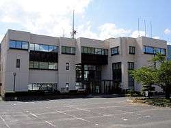 Former Ōhara town hall | |
 Ōhara Location in Japan | |
| Coordinates: 35°7′14.45″N 134°19′33.9″E / 35.1206806°N 134.326083°ECoordinates: 35°7′14.45″N 134°19′33.9″E / 35.1206806°N 134.326083°E | |
| Country | Japan |
| Region | Chūgoku |
| Prefecture | Okayama Prefecture |
| District | Aida |
| Merged |
March 31, 2005 (now part of Mimasaka) |
| Area | |
| • Total | 54.48 km2 (21.03 sq mi) |
| Population (2003) | |
| • Total | 4,630 |
| • Density | 84.99/km2 (220.1/sq mi) |
| Symbols | |
| • Tree | Zelkova serrata |
| • Flower | Lilium japonicum |
| Time zone | UTC+9 (JST) |
Ōhara (大原町 Ōhara-chō) was a town located in Aida District, Okayama Prefecture, Japan.
As of 2003, the town had an estimated population of 4,630 and a density of 84.99 persons per km². The total area was 54.48 km².
On March 31, 2005, Ōhara, along with the towns of Mimasaka, Aida and Sakutō, the village of Higashiawakura (all from Aida District), and the town of Katsuta (from Katsuta District), was merged to create the city of Mimasaka.
Geography
Adjoining municipalities
Education
- Ōhara Elementary School
- Ōhara Junior High School
- Okayama Prefectural Ōhara High School (Closure in 2006)
Transportation
Railways
Road
- National highways:
- Prefectural roads:
- Okayama Prefectural Route 5 (Sakutō-Ōhara)
- Okayama Prefectural Route 240 (Shimoshō-Sayō)
- Okayama Prefectural Route 357 (Kajinami-Tateishi)
Notable places and events
- Village of Miyamoto Musashi
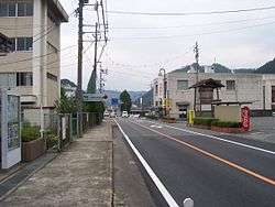
- Ōhara-shuku (Shukuba)
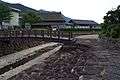 Village of Miyamoto Musashi
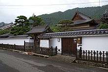 Ōhara-shuku
International Relations
Sister-City
Gleizé is twinned with Ōhara since May 20, 2000. In May 2000 a delegation of the Dojo Hyoho Niten Ichi Ryu from Gleizé is invited to the inauguration of the Budokan dedicated to the Spirit of Miyamoto Musashi in Ōhara.
This twinning was formalized thanks to the support of Ōhara-cho, town of the birth of Miyamoto Musashi.
External links
- Official website of Mimasaka in Japanese