Oceano County Airport
| Oceano County Airport | |||||||||||
|---|---|---|---|---|---|---|---|---|---|---|---|
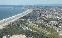 2013 Aerial Photo, facing north | |||||||||||
| Summary | |||||||||||
| Airport type | Public | ||||||||||
| Operator | San Luis Obispo County | ||||||||||
| Location | Oceano, California | ||||||||||
| Elevation AMSL | 14 ft / 4.3 m | ||||||||||
| Coordinates | 35°06′05″N 120°37′20″W / 35.10139°N 120.62222°WCoordinates: 35°06′05″N 120°37′20″W / 35.10139°N 120.62222°W | ||||||||||
| Runways | |||||||||||
| |||||||||||
Oceano County Airport (FAA LID: L52) is a public airport located one mile (1.6 km) west of the central business district (CBD) of Oceano, in San Luis Obispo County, California, USA. The airport covers 58 acres (230,000 m2), has one runway and no control tower. It is mostly used for general aviation, and is walking distance to the sand dunes that line the beach at Oceano.
References
External links
- Resources for this airport:
- FAA airport information for L52
- AirNav airport information for L52
- FlightAware airport information and live flight tracker
- SkyVector aeronautical chart for L52
This article is issued from
Wikipedia.
The text is licensed under Creative Commons - Attribution - Sharealike.
Additional terms may apply for the media files.