Obertaufkirchen
| Obertaufkirchen | ||
|---|---|---|
| ||
 Obertaufkirchen Location of Obertaufkirchen within Mühldorf am Inn district 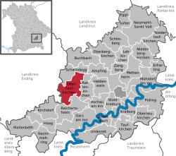 | ||
| Coordinates: 48°16′N 12°17′E / 48.267°N 12.283°ECoordinates: 48°16′N 12°17′E / 48.267°N 12.283°E | ||
| Country | Germany | |
| State | Bavaria | |
| Admin. region | Oberbayern | |
| District | Mühldorf am Inn | |
| Government | ||
| • Mayor | Rudolf Hartinger | |
| Area | ||
| • Total | 31.64 km2 (12.22 sq mi) | |
| Elevation | 457 m (1,499 ft) | |
| Population (2017-12-31)[1] | ||
| • Total | 2,567 | |
| • Density | 81/km2 (210/sq mi) | |
| Time zone | CET/CEST (UTC+1/+2) | |
| Postal codes | 84419 | |
| Dialling codes | 08082 | |
| Vehicle registration | MÜ | |
| Website | www.obertaufkirchen.de | |

Obertaufkirchen is a municipality in the district of Mühldorf in Bavaria in Germany.
References
- ↑ "Fortschreibung des Bevölkerungsstandes". Bayerisches Landesamt für Statistik und Datenverarbeitung (in German). September 2018.
This article is issued from
Wikipedia.
The text is licensed under Creative Commons - Attribution - Sharealike.
Additional terms may apply for the media files.