Oaklands, Gauteng
| Oaklands | |
|---|---|
 Oaklands | |
|
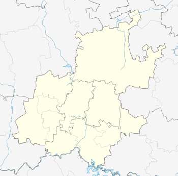
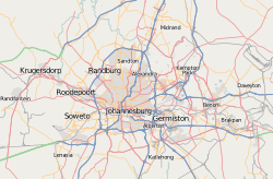
Location within Greater Johannesburg  Oaklands  Oaklands Oaklands (South Africa)  Oaklands Oaklands (Africa) | |
| Coordinates: 26°08′49″S 28°03′54″E / 26.147°S 28.065°ECoordinates: 26°08′49″S 28°03′54″E / 26.147°S 28.065°E | |
| Country | South Africa |
| Province | Gauteng |
| Municipality | City of Johannesburg |
| Main Place | Johannesburg |
| Area[1] | |
| • Total | 1.01 km2 (0.39 sq mi) |
| Population (2011)[1] | |
| • Total | 1,963 |
| • Density | 1,900/km2 (5,000/sq mi) |
| Racial makeup (2011)[1] | |
| • Black African | 32.7% |
| • Coloured | 1.7% |
| • Indian/Asian | 7.8% |
| • White | 56.7% |
| • Other | 1.1% |
| First languages (2011)[1] | |
| • English | 72.9% |
| • Afrikaans | 5.5% |
| • Zulu | 4.8% |
| • Tswana | 3.3% |
| • Other | 13.4% |
| Time zone | UTC+2 (SAST) |
| Postal code (street) | 4339 |
| PO box | 4345 |
| Area code | 2190 |
Oaklands is an affluent suburb of Johannesburg, South Africa. It is located in Johannesburg Region E. It is a small suburb surrounded by the suburbs of Houghton Estate, Norwood, Orchards, The Gardens and Highlands North.
History
Oaklands came into existence in 1896.[2]:162 The lands owner prior to it being surveyed as a township was William Anderson Martin and purchased in 1896, consisting of 18 acres of what is now known as Oaklands and Orchards.[3]:177 Martin would own a large house in suburb called Avonmore a would live there until his death in 1960.[3]:177
The eastern border of the suburb, bounded by Orchards is separated by a seasonal spruit (stream) that has its source in the Houghton Golf Club and with a possible further source on the ridge above Louis Botha Avenue close to Fellside.[4]:376 Most of the stream through the suburb is now either underground or canalized with it eventually forming up with the Orange Grove Spruit and entering the Sandspruit river.[4]:376
References
- 1 2 3 4 "Sub Place Oaklands". Census 2011.
- ↑ Leyds, Gerald Anton (1964). A History of Johannesburg: The Early Years. Nasional Boekhandel. p. 318.
- 1 2 Shorten, John R. (1970). The Johannesburg Saga. Johannesburg: John R. Shorten Pty Ltd. p. 1159.
- 1 2 "Orange Grove Precinct. Heritage Impact Assessment & Conservation Management Plan. Report Phase 3. Volume 3" (PDF). Johannesburg Development Agency (published 16 May 2016). 19 February 2017.