Očauš
| Očauš | |
|---|---|
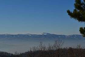 Biser glavica | |
| Highest point | |
| Elevation | 1,402 m (4,600 ft) |
| Coordinates | 44°30′00″N 17°36′50″E / 44.50000°N 17.61389°ECoordinates: 44°30′00″N 17°36′50″E / 44.50000°N 17.61389°E |
| Geography | |
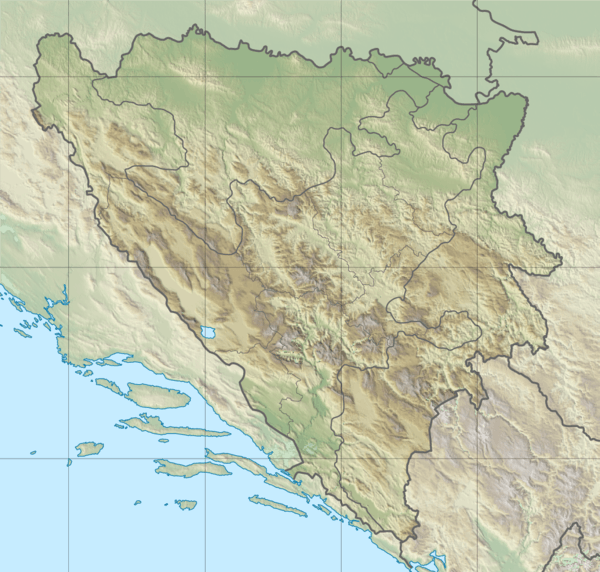 Očauš Location in Bosnia and Herzegovina | |
| Location |
|
| Parent range | Dinaric Alps |
Očauš is a mountain in central Bosnia, the majority in the municipalities of Kotor Varoš and Teslić, at an altitude of 1,402 meters (Mihailovac peak).[1][2][3][4]
Očauš extends in the southeast - northwest, between the river basins of Vrbanja river and Ukrina. It is rich in forest goods and pastures. On this mountain the scattered villages and hamlets, including Upper Očauš, Lower Očauš, Mihajlovačka kosa, Tavani, Ðurđevac, Kilavac, Lepenica, Dolovi, Ceranska kosa, Počivala, Glavička kosa and Mosor.
Očauš is rich in water resources: water wells, streams and rivers, and most are: Očaušnica, Pecana, Kamenica, Stankovac, Vukulja, Kojvana, Stubo, Pavina Voda, Vrela, Jakuša, and Bukaljka.
See also
References
- ↑ http://www.kartabih.com/
- ↑ Vojnogeografski institut, Izd. (1955): Travnik (List karte 1:100.000, Izohipse na 20 m). Vojnogeografski institut, Beograd.
- ↑ Spahić M. et al. (2000): Bosna i Hercegovina (1:250.000). Izdavačko preduzeće „Sejtarija“, Sarajevo.
- ↑ Mučibabić B., Ur. (1998): Geografski atlas Bosne i Hercegovine. Geodetski zavod BiH, Sarajevo, ISBN 9958-766-00-0.
This article is issued from
Wikipedia.
The text is licensed under Creative Commons - Attribution - Sharealike.
Additional terms may apply for the media files.