Noyalo
| Noyalo Noaloù | ||
|---|---|---|
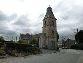 The church in Noyalo | ||
| ||
 Noyalo Location within Brittany region  Noyalo | ||
| Coordinates: 47°36′40″N 2°40′47″W / 47.6111°N 2.6797°WCoordinates: 47°36′40″N 2°40′47″W / 47.6111°N 2.6797°W | ||
| Country | France | |
| Region | Brittany | |
| Department | Morbihan | |
| Arrondissement | Vannes | |
| Canton | Vannes-Est | |
| Intercommunality | Pays de Vannes | |
| Government | ||
| • Mayor (2008—2014) | Xavier-Pierre Boulanger | |
| Area1 | 4.93 km2 (1.90 sq mi) | |
| Population (1999)2 | 666 | |
| • Density | 140/km2 (350/sq mi) | |
| Time zone | UTC+1 (CET) | |
| • Summer (DST) | UTC+2 (CEST) | |
| INSEE/Postal code | 56150 /56450 | |
| Elevation | 0–22 m (0–72 ft) | |
|
1 French Land Register data, which excludes lakes, ponds, glaciers > 1 km2 (0.386 sq mi or 247 acres) and river estuaries. 2 Population without double counting: residents of multiple communes (e.g., students and military personnel) only counted once. | ||
.svg.png)
Noyalo (Breton: Noaloù) is a former commune in the Morbihan department of Brittany in north-western France. On 1 January 2016, it was merged into the new commune Theix-Noyalo.[1]
Demographics
Inhabitants of Noyalo are called in French Noyalais.
See also
References
- ↑ Arrêté préfectoral 5 November 2015 (in French)
- Mayors of Morbihan Association (in French)
- INSEE commune file
External links
| Wikimedia Commons has media related to Noyalo. |
- French Ministry of Culture list for Noyalo (in French)
- Map of Noyalo on Michelin (in English)
This article is issued from
Wikipedia.
The text is licensed under Creative Commons - Attribution - Sharealike.
Additional terms may apply for the media files.