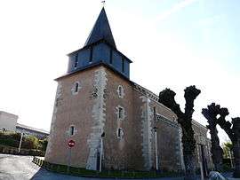
Notre-Dame-de-Sanilhac
| Notre-Dame-de-Sanilhac | |
|---|---|
 | |
 Notre-Dame-de-Sanilhac Location within Nouvelle-Aquitaine region  Notre-Dame-de-Sanilhac | |
| Coordinates: 45°07′21″N 0°42′53″E / 45.1225°N 0.7147°ECoordinates: 45°07′21″N 0°42′53″E / 45.1225°N 0.7147°E | |
| Country | France |
| Region | Nouvelle-Aquitaine |
| Department | Dordogne |
| Arrondissement | Périgueux |
| Canton | Isle-Manoire |
| Area1 | 25.79 km2 (9.96 sq mi) |
| Population (2008)2 | 2,959 |
| • Density | 110/km2 (300/sq mi) |
| Time zone | UTC+1 (CET) |
| • Summer (DST) | UTC+2 (CEST) |
| INSEE/Postal code | 24312 /24660 |
| Elevation |
85–240 m (279–787 ft) (avg. 138 m or 453 ft) |
|
1 French Land Register data, which excludes lakes, ponds, glaciers > 1 km2 (0.386 sq mi or 247 acres) and river estuaries. 2 Population without double counting: residents of multiple communes (e.g., students and military personnel) only counted once. | |
Notre-Dame-de-Sanilhac is a former commune in the Dordogne department in Nouvelle-Aquitaine in southwestern France. On 1 January 2017, it was merged into the new commune Sanilhac.[1]
Population
| Historical population | ||
|---|---|---|
| Year | Pop. | ±% |
| 1831 | 1,037 | — |
| 1836 | 1,015 | −2.1% |
| 1841 | 1,106 | +9.0% |
| 1846 | 1,078 | −2.5% |
| 1851 | 1,211 | +12.3% |
| 1856 | 1,256 | +3.7% |
| 1861 | 1,259 | +0.2% |
| 1866 | 1,285 | +2.1% |
| 1872 | 1,286 | +0.1% |
| 1876 | 1,385 | +7.7% |
| 1881 | 1,464 | +5.7% |
| 1886 | 1,509 | +3.1% |
| 1891 | 1,518 | +0.6% |
| 1896 | 1,511 | −0.5% |
| 1901 | 1,411 | −6.6% |
| 1906 | 1,292 | −8.4% |
| 1911 | 1,285 | −0.5% |
| 1921 | 1,224 | −4.7% |
| 1926 | 1,218 | −0.5% |
| 1931 | 1,152 | −5.4% |
| 1936 | 1,214 | +5.4% |
| 1946 | 1,276 | +5.1% |
| 1954 | 1,277 | +0.1% |
| 1962 | 1,760 | +37.8% |
| 1968 | 1,927 | +9.5% |
| 1975 | 2,062 | +7.0% |
| 1982 | 2,220 | +7.7% |
| 1990 | 2,577 | +16.1% |
| 1999 | 2,616 | +1.5% |
| 2008 | 2,959 | +13.1% |
See also
References
- ↑ Arrêté préfectoral 26 September 2016 (in French)
| Wikimedia Commons has media related to Notre-Dame-de-Sanilhac. |
This article is issued from
Wikipedia.
The text is licensed under Creative Commons - Attribution - Sharealike.
Additional terms may apply for the media files.