North Carolina's 6th congressional district
| North Carolina's 6th congressional district | |
|---|---|
.tif.png) North Carolina's 6th congressional district - since January 3, 2017. | |
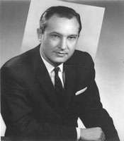
| Current Representative | Mark Walker (R–Greensboro) |
| Distribution |
|
| Population (2016) | 763,491[2] |
| Median income | 39,710 |
| Ethnicity |
|
| Cook PVI | R+9[3] |
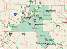
North Carolina's 6th congressional district is located in north central portion of the state and borders Virginia. As a result of reapportionment following the 2010 census, the district was shifted northward by the Redistricting Committee of the NC Senate. The 6th district includes portions of Guilford, Alamance, Durham, Granville, and Orange counties, and all of Caswell, Person, Rockingham, Surry, and Stokes counties.
The district is represented by Mark Walker, a Republican. He has held this position since 2015.
History
From 2003 to 2013 the 6th District comprised all of Moore and Randolph counties and portions of Alamance, Davidson, Guilford, and Rowan counties.
List of representatives
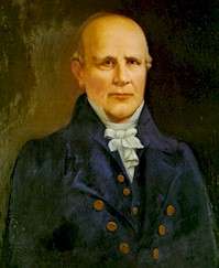
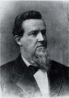
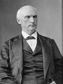
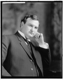
| Representative | Party | Years | Note | |
|---|---|---|---|---|
| District created March 4, 1793 | ||||
 |
Anti-Administration | March 4, 1793 – March 3, 1795 | ||
| Democratic-Republican | March 4, 1795 – March 3, 1799 | |||
|
Federalist | March 4, 1799 – March 3, 1803 | ||
 |
Democratic-Republican | March 4, 1803 - December 13, 1815 | Redistricted from the 5th district Resigned after being elected to U.S. Senate | |
|
Democratic-Republican | February 7, 1816 – March 3, 1823 | ||
| Crawford D-R | March 4, 1823 – March 3, 1825 | |||
| Jacksonian | March 4, 1825 – March 3, 1827 | |||
|
Jacksonian | March 4, 1827 – March 3, 1829 | ||
|
Jacksonian | March 4, 1829 – November, 1831 | Resigned | |
|
Jacksonian | December 15, 1831 – March 3, 1837 | ||
| Democratic | March 4, 1837 – March 3, 1841 | |||
|
Democratic | March 4, 1841 – March 3, 1843 | Redistricted to the 8th district | |
|
Democratic | March 4, 1843 – March 3, 1847 | Redistricted from the 5th district, Redistricted to the 7th district | |
|
Democratic | March 4, 1847 – March 3, 1853 | Redistricted from the 7th district | |
|
Whig | March 4, 1853 – March 3, 1855 | ||
| Know Nothing | March 4, 1855 – March 3, 1857 | |||
 |
Democratic | March 4, 1857 – March 3, 1859 | ||
 |
Opposition | March 4, 1859 – March 3, 1861 | ||
| Civil War and Reconstruction | ||||
 |
Conservative | July 13, 1868 – March 3, 1869 | ||
 |
Democratic | March 4, 1869 – March 3, 1873 | ||
 |
Democratic | March 4, 1873 – March 3, 1877 | ||
 |
Democratic | March 4, 1877 – March 3, 1881 | ||
|
Democratic | March 4, 1881 – March 3, 1885 | ||
|
Democratic | March 4, 1885 – March 3, 1887 | Redistricted from the At-large district | |
|
Democratic | March 4, 1887 – March 3, 1891 | ||
|
Democratic | March 4, 1891 – March 3, 1895 | ||
 |
Democratic | March 4, 1895 – June 5, 1896 | Lost contested election | |
|
Populist | June 5, 1896 – March 3, 1899 | Won contested election | |
|
Democratic | March 4, 1899 – March 3, 1903 | ||
|
Democratic | March 4, 1903 – March 3, 1907 | ||
 |
Democratic | March 4, 1907 – March 3, 1921 | ||
 |
Democratic | March 4, 1921 – March 3, 1929 | ||
|
Democratic | March 4, 1929 – March 3, 1933 | Redistricted to the 7th district | |
 |
Democratic | March 4, 1933 – January 3, 1939 | ||
 |
Democratic | January 3, 1939 – January 3, 1961 | ||
 |
Democratic | January 3, 1961 – January 3, 1969 | ||
 |
Democratic | January 3, 1969 – January 3, 1981 | ||
 |
Republican | January 3, 1981 – January 3, 1983 | ||
 |
Democratic | January 3, 1983 – January 3, 1985 | ||
 |
Republican | January 3, 1985 – January 3, 2015 | ||
 |
Republican | January 3, 2015 – present | ||
Historical district boundaries
.tif.png)
See also
References
- ↑ https://www.census.gov/geo/maps-data/data/cd_state.html
- ↑ https://www.census.gov/mycd/?st=37&cd=06
- ↑ "Partisan Voting Index – Districts of the 115th Congress" (PDF). The Cook Political Report. April 7, 2017. Retrieved April 7, 2017.
- Martis, Kenneth C. (1989). The Historical Atlas of Political Parties in the United States Congress. New York: Macmillan Publishing Company.
- Martis, Kenneth C. (1982). The Historical Atlas of United States Congressional Districts. New York: Macmillan Publishing Company.
- Congressional Biographical Directory of the United States 1774–present
Coordinates: 36°18′36″N 79°40′54″W / 36.31000°N 79.68167°W
This article is issued from
Wikipedia.
The text is licensed under Creative Commons - Attribution - Sharealike.
Additional terms may apply for the media files.