Norman B. Leventhal Map Center
| Norman B. Leventhal Map Center | |
|---|---|
 Entrance | |
| Housed at | Boston Public Library |
| Curators | Ronald Grim, Stephanie Cyr |
The Norman B. Leventhal Map Center at the Boston Public Library is the steward of the Boston Public Library’s map collection, of over 200,000 historic and contemporary maps and 5,000 atlases. The Norman B. Leventhal Map Center launched in 2004 with a $10 million endowment gift as a public-private partnership between the Boston Public Library (BPL) and map collector and philanthropist Norman B. Leventhal.[1] This partnership has enabled the Norman B. Leventhal Map Center to ensure free public access to the Boston Public Library’s extraordinary cartographic collection.[2]
Norman B. Leventhal envisioned that the Boston Public Library's cartographic collections would be the foundation of educational outreach programs for students of all ages.[3] In support of this goal the Norman B. Leventhal Map Center maintains an interactive website, creates educational curricular materials, and exhibitions that are free to the public and archived online.[4] The Leventhal Map Center has presented a number of successful exhibitions relating to maps, including one in 1999 that coincided with release of the book Leventhal published, Mapping Boston, and in 2004, Faces and Places, which connected residents of Boston to their ancestral places of origin.[5] Other major exhibitions of note include "Journeys of the Imagination" (2006), which explored world maps; "We Are One: Mapping America’s Road from Revolution to Independence" (2015) commemorating the 250th anniversary of Britain’s 1765 Stamp Act, a pivotal moment leading to the American Revolution; and most recently "Regions and Seasons: Mapping Climate through History" (2017) an exhibition exploring five centuries of mapping climatic data.
About the collection
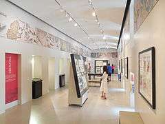
The Norman B. Leventhal Map Center is located in the McKim Building of the central library in Copley Square.
The Norman B. Leventhal Map Center supports researchers and invites teachers to bring their classes to the Boston Public Library for specially planned tours of the collection.
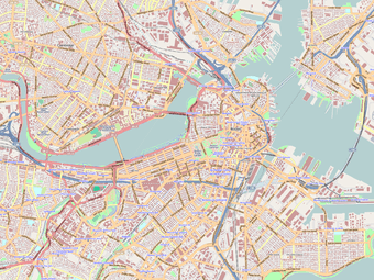
Thousands of maps have been digitized in the Boston Public Library’s Digital Imaging Lab and added to the Norman B. Leventhal Map Center’s website, where they can be viewed using a state of the art zoom feature enabling patrons to see details on the map that would otherwise be difficult to read.[6]
The Norman B. Leventhal Map Center's collections of distinction focus on the exploration and topographic development of New England, Massachusetts, and Boston, as well as the Golden Age of Dutch cartography. Its resources include an important and rare collection of world maps and atlases dating back to 1482, a large collection of bird’s-eye views, and a unique compilation of 18th and 19th century cartographic materials.
Portions of the Norman B. Leventhal Map Collection are on permanent exhibit and available for viewing at the Boston Harbor Hotel and the Langham Hotel in Boston, Massachusetts.
Web portal
The center received a $40,000 grant in 2013 from the National Endowment for the Humanities for a planning project to establish protocols and agreements for creating digital access to 3,000 cartographic images, held by multiple institutions, that document the American Revolutionary War era (1750-1800).[7]
Gallery
A small sample of maps in the collection.
 World Map by Claudius Ptolemy, 1482
 World Map by Hartmann Schedel, 1493
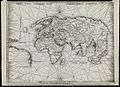 World Map by Martin Waldseemèuller, 1513
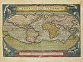 World Map by Abraham Ortelius, 1570
 Paris by Louis Bretez, 1739
References
- ↑ Kahn, Joseph (3 January 2011). "BPL charts modern course". The Boston Globe. Retrieved 12 February 2015.
- ↑ The Norman B. Leventhal Map Center at the Boston Public Library :: Our Mission
- ↑ Thomas C. Palmer Jr., "Maps lead to a public jewel," Boston Globe, 6 September 2007 (2 July 2008)
- ↑ The Norman B. Leventhal Map Center at the Boston Public Library :: History of the NBLMC
- ↑ Thomas C. Palmer Jr., "Maps lead to a public jewel," Boston Globe, 6 September 2007. (2 July 2008)
- ↑ Andrew Ryan, "By Web, a Detailed look at our past," The Boston Globe, 24 March 2007, p B10.
- ↑ "Grant Awards and Offers, April 2013" (PDF). National Endowment for the Humanities. Retrieved 12 February 2015.
Coordinates: 42°20′57.55″N 71°4′41.78″W / 42.3493194°N 71.0782722°W
External links

- Official website
- The Norman B. Leventhal Map Center's atlases and books digitized by the Internet Archive
- Norman B. Leventhal Map Center photos on Flickr
| Authority control |
|---|