Nojals-et-Clotte
| Nojals-et-Clotte | |
|---|---|
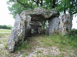 Dolmen | |
 Nojals-et-Clotte Location within Nouvelle-Aquitaine region  Nojals-et-Clotte | |
| Coordinates: 44°43′33″N 0°45′33″E / 44.7258°N 0.7592°ECoordinates: 44°43′33″N 0°45′33″E / 44.7258°N 0.7592°E | |
| Country | France |
| Region | Nouvelle-Aquitaine |
| Department | Dordogne |
| Arrondissement | Bergerac |
| Canton | Lalinde |
| Intercommunality | Pays Beaumontois |
| Government | |
| • Mayor (2008–2014) | Alain Marchadou |
| Area1 | 13.80 km2 (5.33 sq mi) |
| Population (2008)2 | 203 |
| • Density | 15/km2 (38/sq mi) |
| Time zone | UTC+1 (CET) |
| • Summer (DST) | UTC+2 (CEST) |
| INSEE/Postal code | 24310 /24440 |
| Elevation |
110–235 m (361–771 ft) (avg. 156 m or 512 ft) |
|
1 French Land Register data, which excludes lakes, ponds, glaciers > 1 km2 (0.386 sq mi or 247 acres) and river estuaries. 2 Population without double counting: residents of multiple communes (e.g., students and military personnel) only counted once. | |
Nojals-et-Clotte is a former commune in the Dordogne department in southwestern France. On 1 January 2016, it was merged into the new commune Beaumontois-en-Périgord.[1]
Population
| Historical population | ||
|---|---|---|
| Year | Pop. | ±% |
| 1962 | 227 | — |
| 1968 | 213 | −6.2% |
| 1975 | 178 | −16.4% |
| 1982 | 183 | +2.8% |
| 1990 | 177 | −3.3% |
| 1999 | 193 | +9.0% |
| 2008 | 203 | +5.2% |
See also
References
- ↑ Arrêté préfectoral 29 December 2015 (in French)
| Wikimedia Commons has media related to Nojals-et-Clotte. |
This article is issued from
Wikipedia.
The text is licensed under Creative Commons - Attribution - Sharealike.
Additional terms may apply for the media files.