Nitzanei Sinai
| Nitzanei Sinai ניצני סיני | |
|---|---|
| Hebrew transcription(s) | |
| • official | Nizzane Sinay |
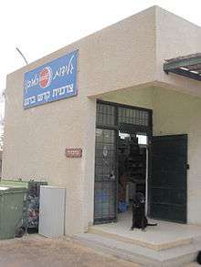
 Sign at entrance reading "Kadesh Barnea" | |
 Nitzanei Sinai | |
| Coordinates: 30°54′13.15″N 34°23′47.47″E / 30.9036528°N 34.3965194°ECoordinates: 30°54′13.15″N 34°23′47.47″E / 30.9036528°N 34.3965194°E | |
| District | Southern |
| Council | Ramat HaNegev |
| Affiliation | Moshavim Movement |
| Founded | 1977 |
| Population (2017)[1] | 279 |
Nitzanei Sinai (Hebrew: נִצָּנֵי סִינַי, ניצני סיני), also known as Kadesh Barnea (Hebrew: קָדֵשׁ בַּרְנֵעַ), is a community settlement in the western Negev desert in Israel. Located near Nitzana, it falls under the juridisction of Ramat Negev Regional Council. In 2017 it had a population of 279.[1]
History
The settlement was founded in 1980 and moved to its present site in 1986 following the Egypt–Israel Peace Treaty.[2] It was named for its proximity to the Sinai, as well as after biblical Kadesh Barnea, one of the stations on the Israelites' journey during the Exodus.[3]
Olive cultivar
Barnea is a modern dual-purpose cultivar bred originally from Kadesh Barnea in southern Israel to be disease-resistant and to produce a generous crop. The oil has a strong flavour with a hint of green leaf. Barnea is widely grown in Israel and in the southern hemisphere, particularly in Australia and New Zealand.
References
- 1 2 "List of localities, in Alphabetical order" (PDF). Israel Central Bureau of Statistics. Retrieved August 26, 2018.
- ↑ Carta's Official Guide to Israel and Complete Gazetteer to all Sites in the Holy Land. (3rd edition 1993) Jerusalem, Carta, p.369, ISBN 965-220-186-3
- ↑ Numbers 13:26; Deuteronomy 1:46