Nieuwerbrug
| Nieuwerbrug | |
|---|---|
| Village | |
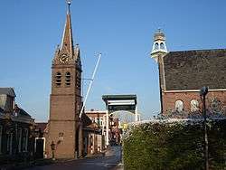 Centre of Nieuwerbrug with the church and toll bridge | |
 | |
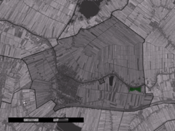 Nieuwerbrug in the municipality of Bodegraven. | |
| Coordinates: 52°4′37″N 4°48′56″E / 52.07694°N 4.81556°ECoordinates: 52°4′37″N 4°48′56″E / 52.07694°N 4.81556°E | |
| Country | Netherlands |
| Province | South Holland |
| Municipality | Bodegraven-Reeuwijk |
| Population (2008) | |
| • Total | 1,763 |
| Time zone | UTC+1 (CET) |
| • Summer (DST) | UTC+2 (CEST) |
| Postal code | 2415 |
Nieuwerbrug is a village in the Dutch province of South Holland. It is a part of the former municipality of Bodegraven, and lies about five kilometres west of Woerden. Bodegraven has made part of the new municipality of Bodegraven-Reeuwijk since 2011.
In 2001, the village of Nieuwerbrug had 978 inhabitants. The built-up area of the village was 0.16 km², and contained 358 residences.[1]
References
- ↑ Statistics Netherlands (CBS), Bevolkingskernen in Nederland 2001. (Statistics are for the continuous built-up area).
This article is issued from
Wikipedia.
The text is licensed under Creative Commons - Attribution - Sharealike.
Additional terms may apply for the media files.