Ngame, Myanmar
| Ngame | |
|---|---|
| town | |
 Ngame Location in Myanmar | |
| Coordinates: 21°04′54″N 92°58′12″E / 21.08167°N 92.97000°ECoordinates: 21°04′54″N 92°58′12″E / 21.08167°N 92.97000°E | |
| Country |
|
| Division | Rakhine State |
| District | Sittwe District |
| Township | Kyauktaw Township |
| Elevation | 187 ft (57 m) |
| Time zone | UTC+6.30 (MST) |
Ngame is a town in Kyauktaw Township, Sittwe District, in the Rakhine State[1] of western Myanmar (formerly known as Burma), located on the right bank of the Kaladan River,[2] just south of the border with Chin State.
References
- ↑ Ngame (BGN Standard), Burma, Rakhine at GEOnet Names Server
- ↑ "Cox's Bazar, Pakistan; Burma; India: NF-46-10" U.S. Army Map Service topographic map 1:250,000, 1954, first printing March 1960
External links
- "Ngame Map — Satellite Images of Ngame", Maplandia.com
Capital: Sittwe | ||
| Kyaukpyu District |  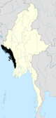 | |
| Maungdaw District | ||
| Sittwe District | ||
| Thandwe District |
| |
| Mrauk-U District | ||
| Main cities and towns | ||
This article is issued from
Wikipedia.
The text is licensed under Creative Commons - Attribution - Sharealike.
Additional terms may apply for the media files.