New Richmond West Side Historic District
|
New Richmond West Side Historic District | |
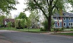 A portion of the district. | |
| Location | Roughly bounded by Willow River, Minnesota Ave., W. Second St., S. Washington Ave., New Richmond, Wisconsin |
|---|---|
| Area | 29 acres (12 ha) |
| Architect | Multiple |
| Architectural style | Late 19th And 20th Century Revivals, Late Victorian |
| MPS | New Richmond MRA |
| NRHP reference # | 88000626[1] |
| Added to NRHP | May 31, 1988 |
The New Richmond West Side Historic District is a 29 acres (12 ha) historic district in New Richmond, Wisconsin. It was added to the National Register of Historic Places in 1988 and then included 28 contributing buildings. The district is roughly bounded by the Willow River, Minnesota Ave., W. Second St., and S. Washington Ave.[1]
The district is south of the Willow River and is in the city's first ward.[2]
References
- 1 2 National Park Service (2010-07-09). "National Register Information System". National Register of Historic Places. National Park Service.
- ↑ "Inventory Forms: New Richmond West Side Historic District". National Park Service. 1986. Retrieved September 12, 2017. With 69 photos from 1986.
This article is issued from
Wikipedia.
The text is licensed under Creative Commons - Attribution - Sharealike.
Additional terms may apply for the media files.