New Bataan, Compostela Valley
| New Bataan | |
|---|---|
| Municipality | |
| Municipality of New Bataan | |
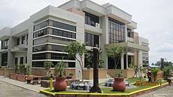 New Bataan Municipal Hall | |
 Map of Compostela Valley with New Bataan highlighted | |
.svg.png) New Bataan Location within the Philippines | |
| Coordinates: 7°32′N 126°08′E / 7.53°N 126.13°ECoordinates: 7°32′N 126°08′E / 7.53°N 126.13°E | |
| Country |
|
| Region | Davao Region (Region XI) |
| Province | Compostela Valley |
| District | 1st District |
| Founded | June 18, 1968 |
| Named for | Bataan |
| Barangays | 16 (see Barangays) |
| Government [1] | |
| • Type | Sangguniang Bayan |
| • Mayor | Gerald Ford Balbin (PDP-Laban) |
| • Vice Mayor | Larie Pagalan (PDP-Laban) |
| • Electorate | 28,517 voters (2016) |
| Area [2] | |
| • Total | 553.15 km2 (213.57 sq mi) |
| Population (2015 census)[3] | |
| • Total | 47,726 |
| • Density | 86/km2 (220/sq mi) |
| Time zone | UTC+8 (PST) |
| ZIP code | 8804 |
| PSGC | 118210000 |
| IDD : area code | +63 (0)87 |
| Climate type | Tropical rainforest climate |
| Income class | 1st municipal income class |
| Revenue (₱) | 165,324,035.46 (2016) |
| Native languages |
Davawenyo Cebuano Kalagan language Mansaka Tagalog Ata Manobo |
| Website |
www |
New Bataan, officially the Municipality of New Bataan, is a 1st class municipality in the province of Compostela Valley, Philippines. According to the 2015 census, it has a population of 47,726 people.[3]
It is about 16 kilometres (9.9 mi) from Compostela, 40 kilometres (25 mi) from the provincial capital Nabunturan, and 75 kilometres (47 mi) from Tagum City. The municipality was founded on June 18, 1968, through Republic Act No. 4756.[4] According to the 2015 census, it has a population of 47,726 people.[3]
The town's festivals include Araw Celebration, held every 18 June; Founder's Day, held every 10 August; Sal’lupongan Festival, held every 13 June. Its patron saint is San Antonio de Padua.
The municipality was one of the hardest-hit towns of Typhoon Bopha when it hit the town on December 3, 2012.[5]
Geography
New Bataan has a total land area of 55,315 hectares (136,690 acres) [2] and situated north and west of Davao Oriental province; south of Municipality of Compostela and west of Municipality of Maragusan. It is surrounded with mountain ranges, and more than 50% of its territory is forest cover that has been the sources of living for some people living there. The barangays of New Bataan that are mostly covered with forest are Andap, Tandawan, Camanlangan, Manurigao. Manurigao is the most remote among the barangay because of the absence of a better road and transportation.
The municipality is also watered by various rivers. One of which is the Mayo River that flows from the mountain of Andap and empties into the Agusan River. The Batoto river is also one of the biggest, it flows from the eastern part of the area. The northeastern portion of the municipality forms part on the contiguous plain of Compostela valley.
Land classification:
- Forest: 33,727.7261 ha (130.223478 sq mi)
- Agro-forest: 2,158.6502 ha (8.334595 sq mi)
- Agricultural: 692.7559 ha (2.674745 sq mi)
- Mining: 6,210.401 ha (23.97849 sq mi)
- Residential: 11.843 ha (0.04573 sq mi)
- Brush land: 2,158.6502 ha (8.334595 sq mi)
- Commercial: 11.5962 ha (0.044773 sq mi)
- Road: 62.06395 ha (0.2396303 sq mi)
- Institutional: 18.91645 ha (0.0730368 sq mi)
- Special use: 3.1605 ha (0.012203 sq mi)
- Industrial: 0.3828 ha (0.001478 sq mi)
- Rivers/canals: 38.3858 ha (0.148208 sq mi)
Barangays
New Bataan is politically divided into 16 barangays,further subdivided into 204 puroks.
| Barangay | PSGC |
|---|---|
| Andap | |
| Bantacan | |
| Batinao | |
| Cabinuangan (Poblacion) | |
| Camanlangan | |
| Cogonon | |
| Fatima | |
| Kahayag | |
| Katipunan | |
| Magangit | |
| Magsaysay | |
| Manurigao | |
| Pagsabangan | |
| Panag | |
| San Roque | |
| Tandawan |
Demographics
| Population census of New Bataan | ||
|---|---|---|
| Year | Pop. | ±% p.a. |
| 1970 | 19,978 | — |
| 1975 | 26,637 | +5.94% |
| 1980 | 32,887 | +4.30% |
| 1990 | 39,629 | +1.88% |
| 1995 | 43,327 | +1.69% |
| 2000 | 42,549 | −0.39% |
| 2007 | 45,309 | +0.87% |
| 2010 | 47,470 | +1.71% |
| 2015 | 47,726 | +0.10% |
| Source: Philippine Statistics Authority[3][6][7][8] | ||
In the 2015 census, the population of New Bataan was 47,726 people,[3] with a density of 86 inhabitants per square kilometre or 220 inhabitants per square mile.
- Birth rate (crude): 28.82 (2005)
- Death rate (crude): 4.12 (2005)
Economy
- Annual local income: P5,761,257.97 (2005)
- Internal revenue allotment: P52,636,316 (2005)
Major crops:
- Coconut
- Rice
- Corn
- Banana
- Coffee/Cacao
- Abaca/Bamboo
Transportation
Road network (within the LGU territory):
- National road: 35.75 kilometres (22.21 mi)
- Provincial road: 40.45 kilometres (25.13 mi)
- Municipal road: 102.50 kilometres (63.69 mi)
References
- ↑ "Municipality". Quezon City, Philippines: Department of the Interior and Local Government. Retrieved 31 May 2013.
- 1 2 "Province: Compostela Valley". PSGC Interactive. Quezon City, Philippines: Philippine Statistics Authority. Retrieved 12 November 2016.
- 1 2 3 4 5 Census of Population (2015). "Region XI (Davao Region)". Total Population by Province, City, Municipality and Barangay. PSA. Retrieved 20 June 2016.
- ↑ Republic Act No. 4756: AN ACT CREATING THE MUNICIPALITY OF NEW BATAAN IN THE PROVINCE OF DAVAO. 1966.
- ↑ "Typhoon death toll climbs to over 200". Inquirer. Retrieved 5 December 2012.
- ↑ Census of Population and Housing (2010). "Region XI (Davao Region)". Total Population by Province, City, Municipality and Barangay. NSO. Retrieved 29 June 2016.
- ↑ Censuses of Population (1903–2007). "Region XI (Davao Region)". Table 1. Population Enumerated in Various Censuses by Province/Highly Urbanized City: 1903 to 2007. NSO.
- ↑ "Province of Compostela Valley". Municipality Population Data. Local Water Utilities Administration Research Division. Retrieved 17 December 2016.
External links
Places adjacent to New Bataan, Compostela Valley | |
|---|---|
Nabunturan (capital) | |
| Municipalities | |