Neot HaKikar
| Neot HaKikar | |
|---|---|
 | |
 Neot HaKikar | |
| Coordinates: 30°55′59.15″N 35°22′36.11″E / 30.9330972°N 35.3766972°ECoordinates: 30°55′59.15″N 35°22′36.11″E / 30.9330972°N 35.3766972°E | |
| District | Southern |
| Council | Tamar |
| Affiliation | Agricultural Union |
| Founded | 1970 |
| Elevation | -345 m (−1,132 ft) |
| Population (2017)[1] | 421 |
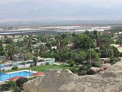
Neot HaKikar (Hebrew: נְאוֹת הַכִּכָּר) is a moshav in the northern Arava valley in Israel established in 1970.[2] Located immediately south of the Dead Sea, at an elevation of 345 metres (1,132 ft) below sea level, it falls under the jurisdiction of Tamar Regional Council. In 2017 it had a population of 421.[1]
Neot HaKikar was the site of the Neot HaKikar disaster, one of Israel's worst natural disasters.
References
| Wikimedia Commons has media related to Neot HaKikar. |
- 1 2 "List of localities, in Alphabetical order" (PDF). Israel Central Bureau of Statistics. Retrieved August 26, 2018.
- ↑ Rained In, Haaretz
This article is issued from
Wikipedia.
The text is licensed under Creative Commons - Attribution - Sharealike.
Additional terms may apply for the media files.