| [2] |
Name on the Register |
Image |
Date listed[3] |
Location |
City or town |
Description |
|---|
| 1 |
Armstrong House |
|
June 29, 1982
(#82002466) |
Broad St.
32°03′04″N 84°47′34″W / 32.051111°N 84.792778°W / 32.051111; -84.792778 (Armstrong House) |
Lumpkin |
|
| 2 |
Bedingfield Inn |
|
May 7, 1973
(#73000643) |
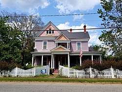
Cotton St.
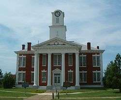
32°03′02″N 84°47′44″W / 32.050556°N 84.795556°W / 32.050556; -84.795556 (Bedingfield Inn) |
Lumpkin |
Built c. 1836 |
| 3 |
Bush-Usher House |
|
June 29, 1982
(#82002467) |
E. Main St.
32°02′58″N 84°47′29″W / 32.049444°N 84.791389°W / 32.049444; -84.791389 (Bush-Usher House) |
Lumpkin |
|
| 4 |
Dr. Miller's Office |
|
June 29, 1982
(#82002468) |
E. Main St.
32°03′00″N 84°47′31″W / 32.05°N 84.791944°W / 32.05; -84.791944 (Dr. Miller's Office) |
Lumpkin |
|
| 5 |
East Main Street Residential Historic District |
|
June 29, 1982
(#82002469) |
E. Main St.
32°02′59″N 84°47′34″W / 32.049722°N 84.792778°W / 32.049722; -84.792778 (East Main Street Residential Historic District) |
Lumpkin |
|
| 6 |
Green Grove Church, School, and Cemetery |
|
June 20, 1995
(#95000734) |
4062 Old Lumpkin-Eufaula Rd.
32°00′26″N 84°51′44″W / 32.007222°N 84.862222°W / 32.007222; -84.862222 (Green Grove Church, School, and Cemetery) |
Lumpkin |
|
| 7 |
Dr. R. L. Grier House |
|
June 29, 1982
(#82002470) |
Broad St.
32°03′04″N 84°48′10″W / 32.051111°N 84.802778°W / 32.051111; -84.802778 (Dr. R. L. Grier House) |
Lumpkin |
|
| 8 |
George Y. Harrell House |
|
June 29, 1982
(#82002471) |
Broad St.
32°03′02″N 84°48′09″W / 32.050556°N 84.8025°W / 32.050556; -84.8025 (George Y. Harrell House) |
Lumpkin |
|
| 9 |
Jared Irwin House |
|
June 29, 1982
(#82002472) |
E. Main St.
32°02′58″N 84°47′31″W / 32.049444°N 84.791944°W / 32.049444; -84.791944 (Jared Irwin House) |
Lumpkin |
|
| 10 |
Louvale Church Row Historic District |
|
April 11, 1986
(#86000747) |
US 27
32°10′38″N 84°49′31″W / 32.177222°N 84.825278°W / 32.177222; -84.825278 (Louvale Church Row Historic District) |
Louvale |
|
| 11 |
Lumpkin Commercial Historic District |
|
June 29, 1982
(#82002473) |
Main, Broad, Cotton, and Mulberry Sts.
32°03′00″N 84°47′41″W / 32.05°N 84.794722°W / 32.05; -84.794722 (Lumpkin Commercial Historic District) |
Lumpkin |
|
| 12 |
Mathis House |
|
June 29, 1982
(#82002474) |
E. Main St.
32°03′00″N 84°47′28″W / 32.05°N 84.791111°W / 32.05; -84.791111 (Mathis House) |
Lumpkin |
|
| 13 |
Dr. Thomas B. Miller House |
|
March 2, 1988
(#87001900) |
97 Nicholson St.
32°05′17″N 84°40′06″W / 32.088056°N 84.668333°W / 32.088056; -84.668333 (Dr. Thomas B. Miller House) |
Richland |
|
| 14 |
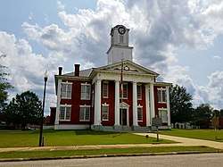
Old Chattahoochee County Courthouse |
|
September 18, 1980
(#80001233) |
SW of Lumpkin, in Westville, being moved to Columbus
32°02′25″N 84°47′13″W / 32.0404°N 84.787°W / 32.0404; -84.787 (Old Chattahoochee County Courthouse) |
Lumpkin |
One of three antebellum courthouses still existing in Georgia. |
| 15 |
Pigtail Alley Historic District |
|
June 29, 1982
(#82002475) |
Old Chestnut Rd.
32°02′49″N 84°48′01″W / 32.046944°N 84.800278°W / 32.046944; -84.800278 (Pigtail Alley Historic District) |
Lumpkin |
|
| 16 |
Nathaniel Prothro Plantation |
|
May 2, 1985
(#85000939) |
Old Americus Rd.
32°06′05″N 84°39′02″W / 32.101389°N 84.650556°W / 32.101389; -84.650556 (Nathaniel Prothro Plantation) |
Richland |
|
| 17 |
Richland Historic District |
|
May 5, 1986
(#86001021) |
Roughly bounded by Ponder, Harmony, Broad and Olemen, and Wali Sts.
32°05′27″N 84°39′45″W / 32.090833°N 84.6625°W / 32.090833; -84.6625 (Richland Historic District) |
Richland |
|
| 18 |
Stoddard Rockwell House |
|
June 29, 1982
(#82002476) |
Rockwell St.
32°03′07″N 84°47′44″W / 32.051944°N 84.795556°W / 32.051944; -84.795556 (Stoddard Rockwell House) |
Lumpkin |
|
| 19 |
Roods Landing Site |
|
August 19, 1975
(#75000609) |
S of Omaha at confluence of Rood Creek and the Chattahoochee River
32°01′40″N 85°02′37″W / 32.027778°N 85.043611°W / 32.027778; -85.043611 (Roods Landing Site) |
Omaha |
|
| 20 |
Second Methodist Church |
|
June 29, 1982
(#82002477) |
Mulberry St.
32°02′49″N 84°47′37″W / 32.046944°N 84.793611°W / 32.046944; -84.793611 (Second Methodist Church) |
Lumpkin |
|
| 21 |
Singer-Moye Archeological Site |
|
August 1, 1975
(#75000608) |
Address Restricted
|
Lumpkin |
|
| 22 |
Smith-Alston House |
|
June 20, 1980
(#80001235) |
405 Ponder St.
32°05′38″N 84°39′42″W / 32.093889°N 84.661667°W / 32.093889; -84.661667 (Smith-Alston House) |
Richland |
|
| 23 |
Stewart County Courthouse |
|
September 18, 1980
(#80001234) |
Courthouse Sq.
32°03′01″N 84°47′40″W / 32.050278°N 84.794444°W / 32.050278; -84.794444 (Stewart County Courthouse) |
Lumpkin |
|
| 24 |
John A. Tucker House |
|
June 29, 1982
(#82002478) |
Florence St.
32°03′10″N 84°47′47″W / 32.052778°N 84.796389°W / 32.052778; -84.796389 (John A. Tucker House) |
Lumpkin |
|
| 25 |
Uptown Residential Historic District |
|
June 29, 1982
(#82002479) |
Broad and Main Sts.
32°03′06″N 84°47′52″W / 32.051667°N 84.797778°W / 32.051667; -84.797778 (Uptown Residential Historic District) |
Lumpkin |
|
| 26 |
Usher House |
|
June 29, 1982
(#82002480) |
Florence St.
32°03′08″N 84°48′04″W / 32.052222°N 84.801111°W / 32.052222; -84.801111 (Usher House) |
Lumpkin |
Built c. 1836 |
| 27 |
West Hill |
|
September 18, 1978
(#78001006) |
S of Lumpkin on U.S. 27
32°00′20″N 84°47′53″W / 32.005556°N 84.798056°W / 32.005556; -84.798056 (West Hill) |
Lumpkin |
|
.jpg)
.jpg)
.JPG)
_(c._1890)_(Richland%2C_GA).JPG)

%3B_Lumpkin%2C_GA.JPG)