Nashton, British Columbia
| Nashton | |
|---|---|
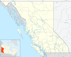
 Nashton Location of Nashton in British Columbia | |
| Coordinates: 49°55′15″N 116°59′10″W / 49.92083°N 116.98611°WCoordinates: 49°55′15″N 116°59′10″W / 49.92083°N 116.98611°W | |
| Country |
|
| Province |
|
Nashton is a ghost town located in the West Kootenay region of British Columbia. Nashton is located at the confluence of Keen Creek and the Kaslo River.[1] The town was founded in 1896 and originally called South Fork. The Kaslo and Slocan Railway passed through the town on its way to Sandon. South Fork became the shipping center for mines such as Alice-Utica, Cork-Province, and Montezuma. South Fork's name was changed to Zwicky. In 1898 the town contained several stores, hotel, and some houses. In 1915 a post office was built and Zwicky was renamed Nashton. The town lasted through several decades. Stagecoaches such as Scott, Baker, and Company passed through Nashton. Today Nashton is deserted.[2]
References
This article is issued from
Wikipedia.
The text is licensed under Creative Commons - Attribution - Sharealike.
Additional terms may apply for the media files.