Napoca (castra)
| Napoca | |
|---|---|
 The fort of Napoca [1] | |
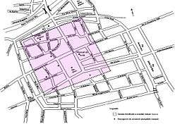
 Location within Romania | |
| Alternative name(s) | Napuca,[2] Napuka [2] |
| Founded during the reign of | Trajan ? |
| Founded | 2nd century AD |
| Attested by | Tabula Peutingeriana |
| Place in the Roman world | |
| Province | Dacia |
| Administrative unit | Dacia Porolissensis |
| Administrative unit | Dacia Superior |
| Structure | |
| — Stone structure — | |
| Size and area | 500 m × 500 m (2.5 [3] ha) |
| Stationed military units | |
| — Cohorts — | |
| |
| Location | |
| Coordinates | 46°46′13″N 23°35′20″E / 46.770353°N 23.588954°E |
| Altitude | 346 m (1,135 ft) |
| Town | Cluj-Napoca |
| County | Cluj |
| Country |
|
| Reference | |
| RO-RAN | 54984.02 [3] |
| Site notes | |
| Condition | Ruined |
Napoca was a Roman castra (fort) in the provice of Dacia.[4]
Napoca in Tabula Peutingeriana
See also
External links
Notes
- ↑ Rusu-Bolindeț, Viorica; Sălăgean, Tudor; Varga, Rada (2010). Archaeologica et Historica in honorem Magistri Dorin Alicu, 2010 -extras.pdf Studia Archaeologica et Historica in Honorem Magistri Dorin Alicu Check
|url=value (help) (PDF). Cluj-Napoca: Argonaut. p. 640. ISBN 978-973-109-237-9. - 1 2 Schütte, Gudmund (1917). "Ptolemy's maps of northern Europe, a reconstruction of the prototypes". The Royal Danish Geographical Society. Retrieved 2013-05-04.
- 1 2 "Situl arheologic "Oraşul antic Napoca" de la Cluj-Napoca". Repertoriul Arheologic Naţional (RAN). Ministerul Culturii şi Patrimoniului Naţional. August 3, 2012. Retrieved October 12, 2013.
- ↑ Crișan, I.H; Bărbulescu, M; Chirilă, E.; Vasiliev, V.; Winkler, I. (1992). Repertoriu arheologic al județului Cluj. Cluj-Napoca,.
Coordinates: 46°46′N 23°35′E / 46.767°N 23.583°E
This article is issued from
Wikipedia.
The text is licensed under Creative Commons - Attribution - Sharealike.
Additional terms may apply for the media files.