Napier Parish, New South Wales
Napier County
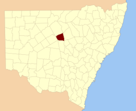
Napier is a rural locality of Warrumbungle Shire Council and a civil parish of Napier County New South Wales.[1][2] and is at 31°35′54″S 149°46′04″E / 31.59833°S 149.76778°E.
Neible is in the Warrembungle Ranges on Oakey Creek. The now closed Oakey Creek Railway Station is within the parish.[3]
References
- ↑ "Napier County". Geographical Names Register (GNR) of NSW. Geographical Names Board of New South Wales.
- ↑ Robert McLean, The New atlas of Australia : the complete work containing over one hundred maps and full descriptive geography of New South Wales, Victoria, Queensland, South Australia and Western Australia, together with numerous illustrations and copious indices (Sydney :J. Sands, [1886) Map 14.
- ↑ Department of Lands, Sydney N.S.W , Map of the County of Napier, Central Division, N.S.W. (Published Sydney : Dept. of Lands, 1964).
This article is issued from
Wikipedia.
The text is licensed under Creative Commons - Attribution - Sharealike.
Additional terms may apply for the media files.