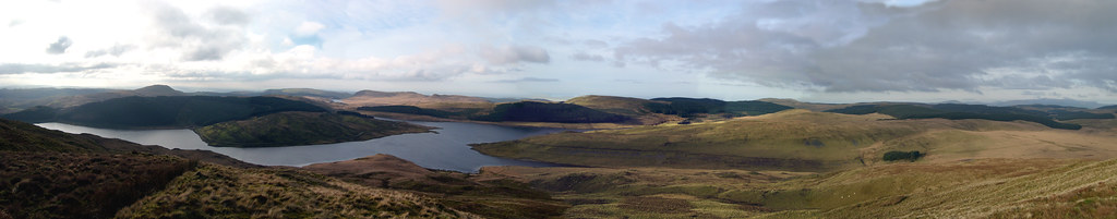
Nant-y-moch Reservoir
| Nant y Moch | |
|---|---|
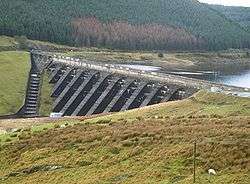 dam spillway | |
| Location | Cambrian Mountains, Wales |
| Coordinates | 52°28′5″N 3°50′22″W / 52.46806°N 3.83944°WCoordinates: 52°28′5″N 3°50′22″W / 52.46806°N 3.83944°W |
| Type | reservoir |
| Basin countries | United Kingdom |
| Surface area | 525 acres (212 ha) |
Nant-y-moch Reservoir ![]()
History
Nant-y-moch Reservoir was created in 1964. The construction of the dam flooded the valley north of it, which included the hamlet of Nant-y-moch. The contents of the graveyard which was to be submerged were relocated to the chapel at Ponterwyd, and a number of cairns were painstakingly moved, some of which dated back as far as the Iron Age.