Nagullanka
| Nagullanka | |
|---|---|
| Village | |
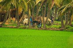 Scenic Greenery by Kotikalapudi | |
 Nagullanka Location in Andhra Pradesh, India | |
| Coordinates: 16°31′58″N 81°52′22″E / 16.53278°N 81.87278°ECoordinates: 16°31′58″N 81°52′22″E / 16.53278°N 81.87278°E | |
| Country | India |
| State | Andhra Pradesh |
| District | East Godavari district |
| Languages | |
| • Official | Telugu |
| Time zone | UTC+5:30 (IST) |
Nagullanka (![]()
Geography
Nagullanka covers a vast portion of the delta area of the Godavari river. This village is located on the north-east coast of Andhra Pradesh. It is bounded by Amalapuram on the north and by Bay of Bengal on the south and by West Godavari district on the west. It is situated between the northern latitudes of 16* 30' and 18* and between 81* 30' and 82* 30' of the eastern longitudes.
References
External links
| Wikimedia Commons has media related to Nagullanka. |
This article is issued from
Wikipedia.
The text is licensed under Creative Commons - Attribution - Sharealike.
Additional terms may apply for the media files.