Na Thom District
| Na Thom นาทม | |
|---|---|
| Amphoe | |
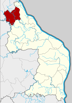 Amphoe location in Nakhon Phanom Province | |
| Coordinates: 17°47′7″N 104°5′26″E / 17.78528°N 104.09056°ECoordinates: 17°47′7″N 104°5′26″E / 17.78528°N 104.09056°E | |
| Country | Thailand |
| Province | Nakhon Phanom |
| Seat | Don Toei |
| Area | |
| • Total | 398.1 km2 (153.7 sq mi) |
| Population (2005) | |
| • Total | 21,930 |
| • Density | 55.1/km2 (143/sq mi) |
| Time zone | UTC+7 (ICT) |
| Postal code | 48140 |
| Geocode | 4811 |
Na Thom (Thai: นาทม, pronounced [nāː tʰōm]) is a district (amphoe) of Nakhon Phanom Province, northeastern Thailand.
Geography
Neighboring districts are (from the east clockwise) Ban Phaeng and Si Songkhram of Nakhon Phanom Province, Akat Amnuai of Sakon Nakhon Province, and Seka and Bueng Khong Long of Nong Khai Province.
History
The minor district (king amphoe) Na Thom was established on 1 April 1992, when three tambons were split off from Ban Phaeng District.[1] It was upgraded to a full district on 11 October 1997.[2]
Administration
The district is divided into three sub-districts (tambon), which are further subdivided into 35 villages (muban). There are no municipal (thesaban), and three tambon administrative organizations (TAO).
| No. | Name | Thai name | Villages | Pop. | |
|---|---|---|---|---|---|
| 1. | Na Thom | นาทม | 15 | 8,310 | |
| 2. | Nong Son | หนองซน | 12 | 8,331 | |
| 3. | Don Toei | ดอนเตย | 8 | 5,289 |
References
- ↑ ประกาศกระทรวงมหาดไทย เรื่อง แบ่งเขตท้องที่อำเภอบ้านแพง จังหวัดนครพนม ตั้งเป็นกิ่งอำเภอนาทม (PDF). Royal Gazette (in Thai). 109 (53 ง special): 12. April 22, 1992.
- ↑ พระราชกฤษฎีกาตั้งอำเภอหนองปรือ อำเภอห้วยกระเจา อำเภอทรายทองวัฒนา อำเภอปางศิลาทอง อำเภอเนินสง่า อำเภอนาทม อำเภอพระพรหม อำเภอแม่วงก์ อำเภอสองแคว อำเภอบ้านใหม่ไชยพจน์ อำเภอไทยเจริญ อำเภอกาบัง อำเภอพยุห์ อำเภอเมืองจันทร์ อำเภอภูพาน อำเภอคลองหอยโข่ง อำเภอเขาฉกรรจ์ อำเภอนาวัง อำเภอพิบูลย์รักษ์ และอำเภอทุ่งศรีอุดม พ.ศ. ๒๕๔๐ (PDF). Royal Gazette (in Thai). 114 (50 ก): 24–27. September 26, 1997.
External links
This article is issued from
Wikipedia.
The text is licensed under Creative Commons - Attribution - Sharealike.
Additional terms may apply for the media files.