Na Khun Yai
| Na Khun Yai นาคูณใหญ่ | |
|---|---|
| Tambon | |
| Country |
|
| Province | Nakhon Phanom |
| District | Na Wa |
| Area | |
| • Total | 17.734 km2 (6.847 sq mi) |
| Population (2005) | |
| • Total | 4,565 |
| • Density | 260/km2 (670/sq mi) |
| Postal Code | 48180 |
| Geocode | 480904 |
Na Khun Yai (Thai: นาคูณใหญ่) is a subdistrict (tambon) in the Nakhon Phanom province, administrated by Na Wa district in north-eastern Thailand (Isaan).
The village is located about 900 km north of Bangkok. Na Khun Yai is underdeveloped, with agriculture as the main economic activity.
Geography
Neighboring tambon are Phon Suang (Si Songkhram district) to the north and east and Na Wa to the south and west.
History
The subdistrict was created on May 1, 1978, when 5 villages were split off from the subdistrict Na Wa.[1]
Administration
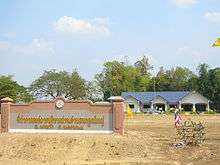
Administrative Building of Tambon Na Khun Yai
The tambon is administrated by a Tambon administrative organization (TAO), which was created on February 13, 1997.[2] It is subdivided into seven villages (muban).
| 1. | Ban Muang | บ้านม่วง | |
| 2. | Ban Na Khun Yai | บ้านนาคูณใหญ่ | |
| 3. | Ban Na Khun Yai | บ้านนาคูณใหญ่ | |
| 4. | Ban Na Khun Noi | บ้านนาคูณน้อย | |
| 5. | Ban Hua Ngua | บ้านหัวงัว | |
| 6. | Ban Na Khun Noi | บ้านนาคูณน้อย | |
| 7. | Ban Muang | บ้านม่วง |
References
- ↑ ประกาศกระทรวงมหาดไทย เรื่อง ตั้งและเปลี่ยนแปลงเขตตำบลในท้องที่อำเภอบ้านแพง กิ่งอำเภอนาหว้า อำเภอศรีสงคราม และอำเภอนาแก จังหวัดนครพนม (PDF). Royal Gazette (in Thai). 95 (62 ง): 1728–1733. 1978-06-13.
- ↑ ประกาศกระทรวงมหาดไทย เรื่อง จัดตั้งองค์การบริหารส่วนตำบล (จำนวน ๓๖๓๗ แห่ง) (PDF). Royal Gazette (in Thai). 113 (พิเศษ 52 ง): 1–365. December 25, 1453.
External links

Southern part of Na Khun Yai
| Wikimedia Commons has media related to Na Khun Yai. |
- nakoonyai.org Na Khun Yai TAO (Thai)
- Na Khun Yai on Thaitambon.com (Thai)
- Gallery of Na Khun Yai (private page)
Coordinates: 17°30′41″N 104°8′11″E / 17.51139°N 104.13639°E
This article is issued from
Wikipedia.
The text is licensed under Creative Commons - Attribution - Sharealike.
Additional terms may apply for the media files.