Nüsttal
| Nüsttal | ||
|---|---|---|
| ||
 Nüsttal Location of Nüsttal within Fulda district 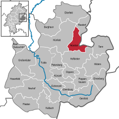  | ||
| Coordinates: 50°38′N 09°51′E / 50.633°N 9.850°ECoordinates: 50°38′N 09°51′E / 50.633°N 9.850°E | ||
| Country | Germany | |
| State | Hesse | |
| Admin. region | Kassel | |
| District | Fulda | |
| Government | ||
| • Mayor | Marion Frohnapfel (CDU) | |
| Area | ||
| • Total | 45.5 km2 (17.6 sq mi) | |
| Elevation | 361 m (1,184 ft) | |
| Population (2017-12-31)[1] | ||
| • Total | 2,804 | |
| • Density | 62/km2 (160/sq mi) | |
| Time zone | CET/CEST (UTC+1/+2) | |
| Postal codes | 36167 | |
| Dialling codes | 06684, 06652 | |
| Vehicle registration | FD | |
| Website | www.nuesttal.de | |

Nüsttal is a municipality in the district of Fulda, in Hesse, Germany.
Towns and municipalities in Fulda district | ||
|---|---|---|
References
- ↑ "Bevölkerung der hessischen Gemeinden". Hessisches Statistisches Landesamt (in German). September 2018.
This article is issued from
Wikipedia.
The text is licensed under Creative Commons - Attribution - Sharealike.
Additional terms may apply for the media files.