Myrtle Springs, Texas
| Myrtle Springs, Texas | |
|---|---|
| CDP | |
| Coordinates: 32°36′54″N 95°55′58″W / 32.61500°N 95.93278°W | |
| Country | United States |
| State | Texas |
| County | Van Zandt |
| Area | |
| • Total | 7.4 sq mi (19.2 km2) |
| • Land | 7.3 sq mi (18.9 km2) |
| • Water | 0.1 sq mi (0.3 km2) |
| Population (2010) | |
| • Total | 828 |
| • Density | 110/sq mi (43/km2) |
| Time zone | UTC-6 (Central (CST)) |
| • Summer (DST) | UTC-5 (CDT) |
| Zip Code | 75169 |
Myrtle Springs is a census-designated place (CDP) in Van Zandt County, Texas, United States. This was a new CDP for the 2010 census with a population of 828.[1]
Geography
Myrtle Springs is located at 32°36′54″N 95°55′58″W / 32.61500°N 95.93278°W (32.615084, -95.932873). The CDP has a total area of 7.4 square miles (19 km2), of which, 7.3 square miles (19 km2) of it is land and 0.1 square miles (0.26 km2) is water.[2]
References
- ↑ "Population and Housing Unit Counts, 2010 Census of Population and Housing" (PDF). Texas: 2010. Retrieved 2017-01-02.
- ↑ "Boundary Map of Myrtle Springs, Texas". MapTechnica. Retrieved 2017-01-02.
Municipalities and communities of Van Zandt County, Texas, United States | ||
|---|---|---|
| Cities | 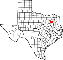 | |
| Town | ||
| CDPs | ||
| Other unincorporated communities | ||
| Ghost towns | ||
This article is issued from
Wikipedia.
The text is licensed under Creative Commons - Attribution - Sharealike.
Additional terms may apply for the media files.