Myra, Texas
| Myra, Texas | |
|---|---|
| Unincorporated community | |
 Myra Location within the state of Texas  Myra Myra (the US) | |
| Coordinates: 33°37′30″N 97°18′56″W / 33.62500°N 97.31556°WCoordinates: 33°37′30″N 97°18′56″W / 33.62500°N 97.31556°W | |
| Country | United States |
| State | Texas |
| County | Cooke |
| Elevation | 935 ft (285 m) |
| Population (2000) | |
| • Total | 230 |
| Time zone | UTC-6 (Central (CST)) |
| • Summer (DST) | UTC-5 (CDT) |
| ZIP codes | 76253 |
| GNIS feature ID | 1363560 |
Myra is an unincorporated community in western Cooke County, Texas, United States. It lies just off U.S. Route 82 west of the city of Gainesville, the county seat of Cooke County.[1] Its elevation is 935 feet (285 m).[2] Although it is unincorporated, it had a post office, with the ZIP code of 76253 until early 2013. It is now closed.[3]
References
- ↑ Rand McNally. The Road Atlas '08. Chicago: Rand McNally, 2008, p. 100.
- ↑ U.S. Geological Survey Geographic Names Information System: Myra, Texas, Geographic Names Information System, 1979-11-30. Accessed 2008-04-12.
- ↑ Zip Code Lookup
Municipalities and communities of Cooke County, Texas, United States | ||
|---|---|---|
| Cities | 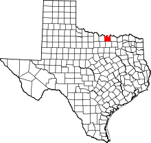 | |
| Towns | ||
| CDP | ||
| Unincorporated communities | ||
This article is issued from
Wikipedia.
The text is licensed under Creative Commons - Attribution - Sharealike.
Additional terms may apply for the media files.