Mynydd y Gaer
| Mynydd y Gaer | |
|---|---|
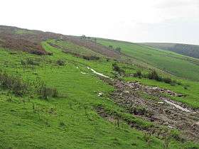 Eastern slopes of Mynydd y Gaer | |
| Highest point | |
| Elevation | 295 m (968 ft) |
| Coordinates | 51°33′42″N 3°30′39″W / 51.5617°N 3.5108°WCoordinates: 51°33′42″N 3°30′39″W / 51.5617°N 3.5108°W |
| Naming | |
| Translation | hill of the fort (Welsh) |
| Geography | |
| Location | Bridgend, Wales |
| OS grid | SS 954858 |
| Topo map | OS Landranger 170 / Explorer 151 |
Mynydd y Gaer is a 295-metre-high hill in Bridgend County Borough in South Wales. The summit is crowned by a trig point.
Geology
The hill is formed from sandstones of the Pennant Sandstone Formation assigned to the Warwickshire Group laid down late in the Carboniferous Period. The strata here dip moderately steeply northwards into the South Wales Coalfield syncline. A number of coal seams are recorded as outcropping on the hillside including the No 1 Rhondda, No 2 Rhondda, Brithdir and Brithdir Rider.[1][2]
Access
The upper parts of the hill are mapped as open access under the Countryside and Rights of Way Act 2000 and so open to public access on foot. A public footpaths and a byway climb the southwest and southeast slopes of the hill respectively from a car park at the end of a minor road from the nearby village of Heol-y-Cyw. Both rights of way are followed by the Ogwr Ridgeway Walk. Two further public footpaths climb the hill’s northern slopes from the direction of Glynogwr.[3]
References
- ↑ British Geological Survey 1:50,000 map sheet 248 Pontypridd & accompanying memoir
- ↑ BGS ‘Geology of Britain’ viewer
- ↑ Ordnance Survey Explorer maps 151 Cardiff & Bridgend & 166 Rhondda & Merthyr Tydfil/Merthy Tudful