Musa ka Musala
| Musa ka Musala | |
|---|---|
 | |
| Highest point | |
| Elevation | 4,080 m (13,390 ft) |
| Coordinates | 34°42′58″N 73°21′37″E / 34.716044°N 73.360241°ECoordinates: 34°42′58″N 73°21′37″E / 34.716044°N 73.360241°E |
| Geography | |
| Location | Mansehra, Pakistan |
| Parent range | Himalaya |

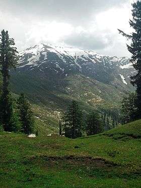
Musa Ka Musalla from Khanian village.
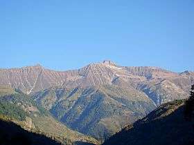
Musa Ka Musalla (Kaghan Valley face).
Musa Ka Musala stands at an altitude of 4080 meters at the junction of Siran and Kaghan Valleys in Himalaya.
It is situated 150 kilometres (93 mi) north of the city of Abbottabad in Himalayas, Pakistan. A road from Shinkiari, a tehsil of District Mansehra, leads up to Mandagucha the most frequently used trek is Mandagucha, Jacha, Bikhi, Jabbar, Khorri (Gali) and Choti ZiaraGali.[1]
See also
References
- ↑ "Hidden Tourist Attractions of Pakistan". Archived from the original on 2014-01-04. Retrieved 2013-02-03.
This article is issued from
Wikipedia.
The text is licensed under Creative Commons - Attribution - Sharealike.
Additional terms may apply for the media files.