Murrieta Hot Springs, California
| Murrieta Hot Springs, California | |
|---|---|
| District of Murrieta | |
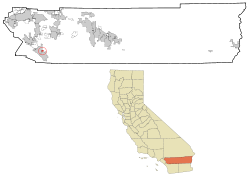 Location in Riverside County and the state of California | |
| Coordinates: 33°33′46″N 117°9′20″W / 33.56278°N 117.15556°WCoordinates: 33°33′46″N 117°9′20″W / 33.56278°N 117.15556°W | |
| Country | United States |
| State | California |
| County | Riverside |
| Area | |
| • Total | 1.3 sq mi (3.3 km2) |
| • Land | 1.3 sq mi (3.3 km2) |
| • Water | 0 sq mi (0 km2) |
| Elevation | 1,194 ft (364 m) |
| Population (2000) | |
| • Total | 2,948 |
| • Density | 2,267.7/sq mi (893.3/km2) |
| Time zone | UTC-8 (PST) |
| • Summer (DST) | UTC-7 (PDT) |
| ZIP codes | 92562-92564 |
| Area code(s) | 951 |
| FIPS code | 06-50090 |
| GNIS feature ID | 1661080 |
Murrieta Hot Springs is an eastern neighborhood region of Murrieta, California, which was annexed on July 1, 2002. Prior to annexation, Murrieta Hot Springs was a Census-designated place of Riverside County, California. The population was 2,948 at the 2000 census.[1]
French Valley Airport (FAA designator: F70), near Murrieta Hot Springs, has a 6,000-foot (1,800 m) runway.
Geography
Murrieta Hot Springs is located at 33°33′46″N 117°9′20″W / 33.56278°N 117.15556°W (33.562880, -117.155610).[2]
According to the United States Census Bureau, the CDP has a total area of 1.3 square miles (3.3 km²), of which, 1.3 square miles (3.3 km²) of it is land and 0.78% is water.
History
The local Indians who first visited the area called the springs Cherukanukna Hakiwuna [3] The Indians bathed in the warm waters and believed the springs had healing powers.[4][5]
Fritz Guenther, a German emigrant, bought the Murrieta Hot Springs tract in 1902 and developed a world-class health spa resort. The Guenther family sold the property in 1970 to Irvin Kahn, an attorney and real estate developer.[6]
Calvary Chapel of Costa Mesa purchased the former resort in 1995 and began restoration efforts. The resort was transformed into a Christian college and conference center.[7]
Demographics
As of the census[8] of 2000, there were 2,948 people, 1,340 households, and 769 families residing in the CDP. The population density was 2,306.6 people per square mile (889.2/km²). There were 1,457 housing units at an average density of 1,140.0 per square mile (439.5/km²). The racial makeup of the CDP was 91.86% White, 1.56% African American, 0.64% Native American, 1.93% Asian, 0.03% Pacific Islander, 1.70% from other races, and 2.27% from two or more races. Hispanic or Latino of any race were 8.11% of the population.
There were 1,340 households out of which 8.4% had children under the age of 18 living with them, 49.8% were married couples living together, 6.3% had a female householder with no husband present, and 42.6% were non-families. 38.5% of all households were made up of individuals and 28.2% had someone living alone who was 65 years of age or older. The average household size was 1.85 and the average family size was 2.37.
In the CDP the population was spread out with 8.1% under the age of 18, 16.0% from 18 to 24, 13.0% from 25 to 44, 19.4% from 45 to 64, and 43.6% who were 65 years of age or older. The median age was 61 years. For every 100 females there were 82.4 males. For every 100 females age 18 and over, there were 81.2 males.
The median income for a household in the CDP was $27,311, and the median income for a family was $35,102. Males had a median income of $39,081 versus $28,594 for females. The per capita income for the CDP was $19,991. About 5.2% of families and 6.3% of the population were below the poverty line, including none of those under age 18 and 6.5% of those age 65 or over.
Government
In the California State Legislature, Murrieta Hot Springs is in the 28th Senate District, represented by Republican Jeff Stone, and in the 67th Assembly District, represented by Republican Melissa Melendez.[9]
In the United States House of Representatives, Murrieta Hot Springs is in California's 42nd congressional district, represented by Republican Ken Calvert.[10]
References
- ↑ http://www3.murrieta.org/agendas/council/MG27382/AS27385/AS27396/AI27507/DO27619/1.PDF
- ↑ "US Gazetteer files: 2010, 2000, and 1990". United States Census Bureau. 2011-02-12. Retrieved 2011-04-23.
- ↑ Murrieta, Old Town, New Town, A Community History, page 53; ISBN 0-9648634-0-5
- ↑ Along the Old Roads, A History of the Portion of Southern California that became Riverside County 1772 – 1893, page 338; ISBN 0983750025
- ↑ A Thousand Years in Temecula Valley by Tom Hudson, page 177; ISBN 093170006X ISBN 978-0931700064
- ↑ Murrieta Hot Springs, Images of America ISBN 978-0-7385-5956-8
- ↑ Murrieta Hot Springs Christian Conference Center; https://www.mhsretreats.com/visit/?section=history#history
- ↑ "American FactFinder". United States Census Bureau. Retrieved 2008-01-31.
- ↑ "Statewide Database". UC Regents. Retrieved December 8, 2014.
- ↑ "California's 42nd Congressional District - Representatives & District Map". Civic Impulse, LLC.