Mulu Airport
| Mulu Airport Lapangan Terbang Mulu | |||||||||||
|---|---|---|---|---|---|---|---|---|---|---|---|
| Summary | |||||||||||
| Airport type | Public | ||||||||||
| Owner | Government of Malaysia | ||||||||||
| Operator | Malaysia Airports Berhad | ||||||||||
| Serves | Gunung Mulu National Park, Sarawak, East Malaysia | ||||||||||
| Location | Mulu, Sarawak, East Malaysia | ||||||||||
| Time zone | MST (UTC+08:00) | ||||||||||
| Elevation AMSL | 80 ft / 24 m | ||||||||||
| Coordinates | 04°03′02″N 114°48′33″E / 4.05056°N 114.80917°ECoordinates: 04°03′02″N 114°48′33″E / 4.05056°N 114.80917°E | ||||||||||
| Map | |||||||||||
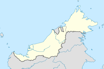 WBMU Location on Borneo, in East Malaysia | |||||||||||
| Runways | |||||||||||
| |||||||||||
| Statistics (2017) | |||||||||||
| |||||||||||
Mulu Airport (IATA: MZV[3], ICAO: WBMU) is an airport in the state of Sarawak in Malaysia and a gateway to the Gunung Mulu National Park. There are resort accommodations at the National Park, but the nearest villages are Long Terawan, downstream 21.7 km (13.5 mi) to the west, and Long Atip 26.1 km (16.2 mi) to the south. Rumah Bawang Grang in Brunei is only 23.1 km (14.4 mi) to the north-northwest, but there is no road connected to the airport.
Airlines and destinations
| Airlines | Destinations |
|---|---|
| Malaysia Airlines operated by MASwings | Kota Kinabalu, Kuching, Miri |
See also
References
- ↑ "Mulu Airport Factsheet" (PDF). Malaysia Airports Holdings Berhad. Retrieved 10 October 2018.
- ↑ AIP Malaysia: Index to Aerodromes at Department of Civil Aviation Malaysia
- ↑ Airport information for MZV at Great Circle Mapper. Source: DAFIF (effective October 2006).
External links
- Short Take-Off and Landing Airports (STOL) at Malaysia Airports Holdings Berhad
- Accident history for MZV at Aviation Safety Network
This article is issued from
Wikipedia.
The text is licensed under Creative Commons - Attribution - Sharealike.
Additional terms may apply for the media files.