Mulmur, Ontario
| Mulmur | |
|---|---|
| Township (lower-tier) | |
| Township of Mulmur | |
.jpg) | |
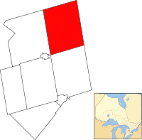 Mulmur within Dufferin County | |
 Mulmur Location of Mulmur within Ontario | |
| Coordinates: 44°11′30″N 80°06′30″W / 44.1917°N 80.1083°WCoordinates: 44°11′30″N 80°06′30″W / 44.1917°N 80.1083°W | |
| Country |
|
| Province |
|
| County | Dufferin |
| Incorporated | January 1, 1851 |
| Government | |
| • Mayor | Paul Mills |
| • Federal riding | Dufferin—Caledon |
| • Prov. riding | Dufferin—Caledon |
| Area[1] | |
| • Land | 286.77 km2 (110.72 sq mi) |
| Population (2011)[1] | |
| • Total | 3,478 |
| • Density | 12.1/km2 (31/sq mi) |
| Time zone | UTC-5 (EST) |
| • Summer (DST) | UTC-4 (EDT) |
| Postal Code | L0N 1M0 |
| Area code(s) | 519 and 226 |
| Website |
www |
Mulmur is a township in Dufferin County in Southern Ontario, Canada. There are a number of original settlements such as Mulmur Corners, some of which can still be identified as to location, including Rosemont and Stanton.[2]
Communities
The township of Mulmur comprises a number of villages and hamlets, including the following communities such as Airlie (partially), Banda (partially), Black Bank, Earnscliffe, Happy Valley, Honeywood, Kilgorie, Lavender (partially), Mansfield, Mulmur, Mulmur Corners (partially), Perm, Ponton Mills, Randwick, Rookery Creek, Rosemont (partially), Ruskview, Scarlet Hill, Slabtown, Stanton, Terra Nova, Violet Hill (partially), Whitfield; Conover, Henderson's Corners (partially), Hipson's Corners; Boyne Mill, Hall's Corners, Old Egypt, Primrose (partially)
Demographics
| Canada census – Mulmur, Ontario community profile | |||
|---|---|---|---|
| 2011 | 2006 | ||
| Population: | 3,391 (2.2% from 2006) | 3,318 (7.1% from 2001) | |
| Land area: | 286.73 km2 (110.71 sq mi) | 286.73 km2 (110.71 sq mi) | |
| Population density: | 11.8/km2 (31/sq mi) | 11.6/km2 (30/sq mi) | |
| Median age: | 45.2 (M: 45.6, F: 44.7) | 42.3 (M: 42.2, F: 42.4) | |
| Total private dwellings: | 1643 | 1,479 | |
| Median household income: | $N/A | ||
| References: 2011[3] 2006[4] earlier[5] | |||
Population trend:[6]
- Population in 2006: 3318
- Population in 2001: 3099
- Population in 1996: 2903
- Population in 1991: 2591
Climate
| Climate data for Ruskview, Ontario (Mulmur) 1981–2010 | |||||||||||||
|---|---|---|---|---|---|---|---|---|---|---|---|---|---|
| Month | Jan | Feb | Mar | Apr | May | Jun | Jul | Aug | Sep | Oct | Nov | Dec | Year |
| Record high °C (°F) | 13.5 (56.3) |
12.0 (53.6) |
22.5 (72.5) |
28.5 (83.3) |
31.5 (88.7) |
33.0 (91.4) |
34.0 (93.2) |
35.0 (95) |
33.0 (91.4) |
28.0 (82.4) |
20.0 (68) |
16.0 (60.8) |
35.0 (95) |
| Average high °C (°F) | −3.6 (25.5) |
−2.9 (26.8) |
2.3 (36.1) |
10.1 (50.2) |
17.1 (62.8) |
22.3 (72.1) |
24.7 (76.5) |
23.7 (74.7) |
19.5 (67.1) |
11.9 (53.4) |
4.9 (40.8) |
−1.3 (29.7) |
10.7 (51.3) |
| Daily mean °C (°F) | −7.3 (18.9) |
−6.8 (19.8) |
−1.9 (28.6) |
5.4 (41.7) |
12.1 (53.8) |
17.4 (63.3) |
19.7 (67.5) |
18.8 (65.8) |
14.7 (58.5) |
7.9 (46.2) |
1.7 (35.1) |
−4.3 (24.3) |
6.4 (43.5) |
| Average low °C (°F) | −10.9 (12.4) |
−10.7 (12.7) |
−6.0 (21.2) |
0.8 (33.4) |
7.0 (44.6) |
12.4 (54.3) |
14.7 (58.5) |
13.9 (57) |
9.9 (49.8) |
3.8 (38.8) |
−1.6 (29.1) |
−7.3 (18.9) |
2.2 (36) |
| Record low °C (°F) | −31.5 (−24.7) |
−30.0 (−22) |
−29.0 (−20.2) |
−13.0 (8.6) |
−3.5 (25.7) |
2.0 (35.6) |
5.0 (41) |
4.0 (39.2) |
−3.0 (26.6) |
−7.0 (19.4) |
−18.5 (−1.3) |
−29.5 (−21.1) |
−31.5 (−24.7) |
| Average precipitation mm (inches) | 85.6 (3.37) |
69.8 (2.748) |
68.0 (2.677) |
73.9 (2.909) |
86.9 (3.421) |
90.8 (3.575) |
81.5 (3.209) |
79.4 (3.126) |
95.4 (3.756) |
83.3 (3.28) |
100.3 (3.949) |
80.9 (3.185) |
995.8 (39.205) |
| Average rainfall mm (inches) | 21.1 (0.831) |
15.7 (0.618) |
31.2 (1.228) |
60.7 (2.39) |
86.7 (3.413) |
90.8 (3.575) |
81.5 (3.209) |
79.4 (3.126) |
95.4 (3.756) |
73.8 (2.906) |
60.8 (2.394) |
21.0 (0.827) |
718.0 (28.268) |
| Average snowfall cm (inches) | 64.6 (25.43) |
54.1 (21.3) |
36.6 (14.41) |
13.2 (5.2) |
0.2 (0.08) |
0.0 (0) |
0.0 (0) |
0.0 (0) |
0.0 (0) |
9.4 (3.7) |
39.5 (15.55) |
59.9 (23.58) |
277.5 (109.25) |
| Average precipitation days (≥ 0.2 mm) | 15.7 | 12.7 | 12.6 | 13.0 | 13.2 | 12.2 | 11.4 | 12.1 | 13.4 | 17.3 | 18.1 | 15.0 | 166.8 |
| Average rainy days (≥ 0.2 mm) | 3.2 | 3.0 | 6.0 | 11.5 | 13.2 | 12.2 | 11.4 | 12.1 | 13.5 | 16.5 | 12.5 | 4.1 | 119.1 |
| Average snowy days (≥ 0.2 cm) | 13.5 | 10.3 | 7.6 | 2.7 | 0.1 | 0.0 | 0.0 | 0.0 | 0.0 | 1.8 | 6.9 | 11.6 | 54.4 |
| Source: Environment Canada[7] | |||||||||||||
See also
References
- 1 2 "Census Profile, 2016 Census - Mulmur, Township". 2016 Census of Population. Government of Canada, Statistics Canada. Retrieved 30 October 2017.
- ↑ "Our Roots / Nos Racines".
- ↑ "2011 Community Profiles". Canada 2011 Census. Statistics Canada. July 5, 2013. Retrieved 2012-08-14.
- ↑ "2006 Community Profiles". Canada 2006 Census. Statistics Canada. March 30, 2011. Retrieved 2009-02-24.
- ↑ "2001 Community Profiles". Canada 2001 Census. Statistics Canada. February 17, 2012.
- ↑ Statistics Canada: 1996, 2001, 2006 census
- ↑ "Ruskview". Canadian Climate Normals 1981−2010. Environment Canada. Retrieved 2016-05-12.
External links

- Township of Mulmur official website
Places adjacent to Mulmur, Ontario | |
|---|---|