Mulleria, Kasaragod
| Mulleria | |
|---|---|
| Town | |
 Mulleria | |
| Coordinates: 12°20′N 75°57′E / 12.33°N 75.95°ECoordinates: 12°20′N 75°57′E / 12.33°N 75.95°E | |
| Country |
|
| State | Kerala |
| District | Kasaragod |
| Government | |
| • Body | Panchayat |
| Languages | |
| • Official | Kannada, Tulu, Malayalam |
| Time zone | UTC+5:30 (IST) |
| PIN | 671543 |
| Telephone code | 04994 |
| Vehicle registration | KL-14 |
| Nearest city | Kasaragod |
| https://www.facebook.com/wermullerianzz/ | |
Mulleria is a Major town and Located in Karadka Panchayath, Kasaragod district in Kerala, India.[1]
Transportation
The western main road from Mulleria to Kasaragod has access to the NH.66, which connects to Mangalore in the north and Calicut in the south. The road to the east connects to Sullia in Karnataka, from where Mysore and Bangalore can be accessed. Moreover, we can easily access to Putthur via Sulliapadav, Karnataka. The nearest railway station is Kasaragod on the Mangalore-Palakkad line. There is an airport at Mangalore.Mulleria town is connect to four major road, which is connect throughout Badiadka, Kumble, Mangalore in the north. And north west connect to Sulliapadav, Puttur through GG Road. In the western Cherkala to Kasaragod and east connected to Bengaluru through mysore and Coorg.
Overview
Mulleria is a small Village/hamlet in Kasargod Taluk in Kasaragod District of Kerala State, India. It comes under Karaduka Panchayath. It belongs to North Kerala Division . It is located 22 km towards East from District headquarters Kasaragod. 16 km from Kasargod. 575 km from State capital Thiruvananthapuram. Kumbadaje ( 7 km ), Badiyadka ( 11 km ), Enmakaje ( 14 km ), Chengala ( 16 km ) are the nearby Villages to Mulleria. Mulleria is surrounded by Kanhangad Taluk towards South, Puttur Taluk towards North, Manjeshwar Taluk towards west, Sulya Taluk towards East . Kasaragod, Puttur, Kanhangad, Payyannur are the nearby Cities to Mulleria. It is near to Arabian sea. There is a chance of humidity in the weather.
Locality Name : Mulleria ( മുള്ളേരിയ , ಮುಳ್ಳೇರಿಯಾ )
Taluk Name : Kasargod
District : Kasaragod
State : Kerala
Division : North Kerala
Language : English, Malayalam, Tulu, Beary Bashe, Kannada, Hindi, Marathi, Karada, Are bashe, Urdu And Konkani.
Elevation / Altitude: 18 meters. Above Seal level
Telephone Code / Std Code: 04994
Assembly constituency : Kasaragod Assembly Constituency
Member of Legislative Assembly : N. A. Nellikkunnu
Lok Sabha constituency : Kasaragod (Lok Sabha constituency)
Member of Parliament : P. Karunakaran
Pin Code : 671543
Post Office Name : Mulleria/Adhur
Main Village Name : Karaduka
Alternate Village Name : Adhur Village
Police station: Adhur
Details of Post Office MULLERIA, KASARGOD
Post Office: MULLERIA
Post Office Type: SUB OFFICE
District: KASARGOD
State: KERALA
Pin Code: 671543
Contact Address: Postmaster, Post Office MULLERIA (SUB OFFICE), KASARGOD, KERALA (KL), India (IN), Pin Code:- 671543
Delivery Status:- DELIVERY
Postal Taluk:- KASARAGOD
Postal Division:- KASARAGOD
Postal Region:- CALICUT
Postal Circle:- KERALA
Clubs
- 1. Shri Vishnu Arts & Sports Club
- 2. Amba bhavani arts & sports club
- 3.Shiva shakthi arts & sports Club
- 4.Eleven star Adhur.
- 5.Chethana Arts & Sports club
- 6.Sri Ram cricketers.
- 7.Nava chethana Beerangole.
- 8.Seva bharathi
- 9.Safdar hasmi Gadigudda
- 10.Red star Karmanthody
- 11.ayodya friends mulleria
Educational Institution
- ALPS MULLERIA
- AUPS MULLERIA
- GVHSS MULLERIA
- VOCATIONAL HIGHER SECONDARY ARTS AND SCIENCE
- Kasaragod Taluk IT Education
- Vidhyashree Sikshana Kendra
About Karadka
According to Census 2011 information the location code or village code of Karadka village is 627111. Karadka village is located in Kasaragod Tehsil of Kasaragod district in Kerala, India. It is situated 23 km away from Kasaragod, which is both district & sub-district headquarter of Karadka village. As per 2009 stats, Karadka village is also a gram panchayat.
The total geographical area of village is 1859 hectares. Karadka has a total population of 9,613 peoples. There are about 2,158 houses in Karadka village. Kasaragod is nearest town to Karadka which is approximately 23 km away.
President Ms. Swapna G (BJP)
Population of Karadka
Total Population 9,613
Male Population 4,693
Female Population 4,920
Nearby Villages of Karadka
- Ubrangala
- Kumbadaje
- Nettanige
- Bellur
- Adhur
- Muliyar
- Kolathur
- Bedadka
- Munnad
- Kuttikole
- Karivedakam
Tourism
Kasaragod is often named as land of Lords and Forts and one of the most beautiful districts in Kerala state endowed with 9 rivers (out of a total of the 44 rivers that flow in Kerala), hills, beaches, backwaters, as well as temples, churches, mosques and forts. Mulleria is well known for its rich cultural and natural beauty. Temples, mosque, are mainly attracted so many pilgrims to Mulleria .
Auditoriums
1.Ganesh Kala Mandir
2.Kalyan Auditorium
Image gallery
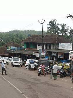
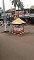 Mulleria town
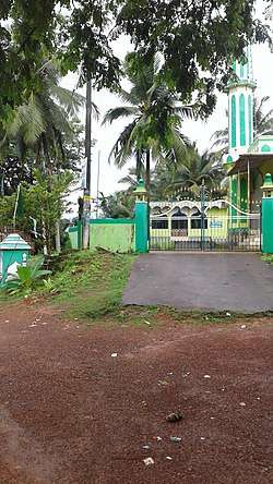 Kundar mosque
See also
External links
References
- ↑ "Census of India : Villages with population 5000 & above". Registrar General & Census Commissioner, India. Archived from the original on 8 December 2008. Retrieved 2008-12-10.